04.05.2012: I have taken over the role of flight test advisor within EAS, which means I help colleagues who finished their planes to perform the flight testing according to the rules described in the EAS processes and agreed with the authorities.
The EAS chief flight test advisor asked me whether I would do that as many flight test advisors have given up their role due to age, and there is none left east of Biel, which means in the eastern half of Switzerland. It seems that I did my own flight testing properly enough to qualify for the job.
Being the flight test advisor does not mean I am actually testing planes, I just help the builders to follow all processes, to make critical decisions with the necessary caution and to document everything properly.
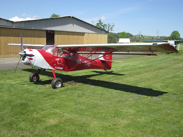
The first plane will be a Kitfox IV, HB-YHO, which can be seen below. The plane has passed it’s final inspection by the authorities and the builder decided to do some ground testing today. That included engine runs, as well as handling testing during taxiing. The builder is still getting some flight training on another Kitfox, so the first flight is probably still two to three weeks away.
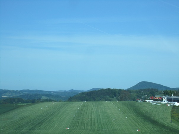
17.05.2012: My last flight was nearly three weeks ago, mostly due to bad weather, so I took advantage of the nice, but quite windy day. We decided to fly to Fricktal-Schupfart (LSZI), which is only around half an hour west of Lommis, for an ice cream. For the flight to Fricktal we flew the usual route around the northern limit of the CRT of Zurich Airport. The maximum permitted altitude under the lowest TMA sector on the route is 3’000 ft AMSL, which is just about 1’000 ft AGL,. We then followed the Rhine river to Bad Säckingen. Below a view of the airfield, shortly before turning onto final. .
The airfield is a bit special, as the runway is not level, but extends over a small hill, so one lands uphill from both sides.
Here a picture take shortly before touchdown, where the slope is clearly visible.
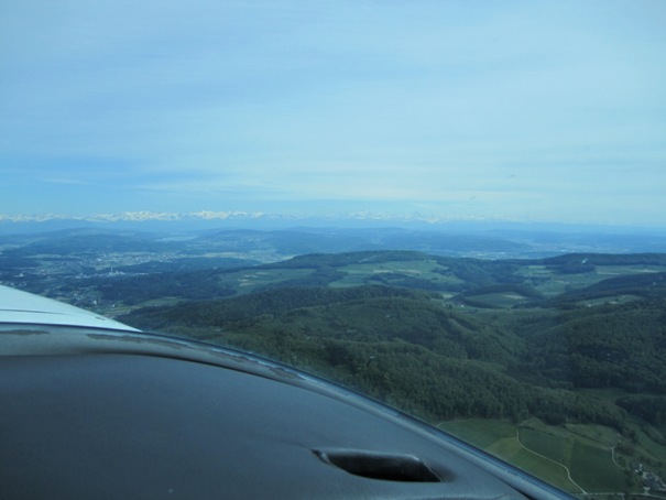
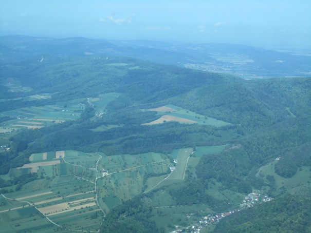
On the way back we flew around the southern limit of the CTR of Zurich Airport, with a nice view on the mountains.
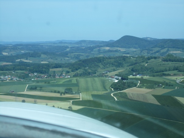
19.05.2012: Today we went for the EAS Spring Fly-In, which should have taken place a week ago but had to be postponed by a week due to bad weather. It took place at the Aérodrome du Jura in Bressaucourt, the first new airfield established in Switzerland in probably several decades. It opened only a year ago, and I visited it already once shortly after the opening. Below a picture of Runway 07 on final approach.
We took the same route as two days ago past the CTR of Zurich Airport, but then climbed to 4’500 ft after passing due to the bumpy weather. We then continued to Basel, where I asked for a transit of the TMA as I did not feel to fly low again. The TMA south of Basel extends down to 1’000 ft AGL, which I considered too low with 20 kts of wind.
We passed Dittingen airfield, which lies under the 1’000 ft AGL limit. It’s a glider only airfield, which is even sillier with that ceiling, so I guess those glider pilots flying there have a lot of routine talking to ATC. The airfield can be seen on the picture below.
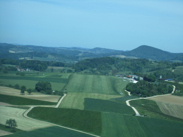
We then continued to Bressaucourt, here a picture taken on final.

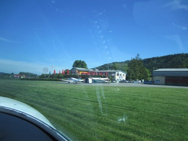
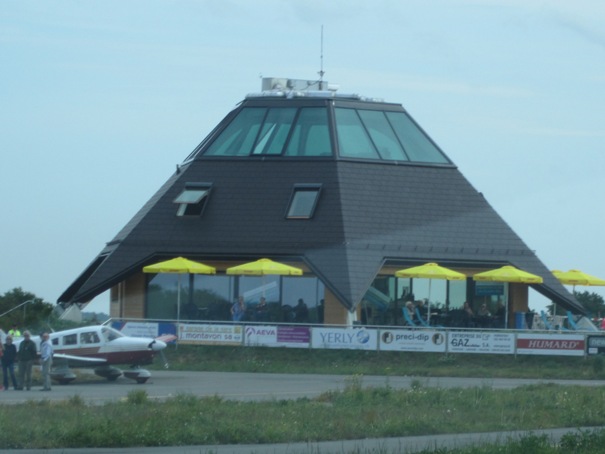
Below the futuristic looking airport building, which includes a restaurant that just opened recently.
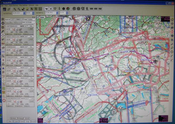
20.05.2012: Last February we had a flight planning seminar at our flying club, where several flight planning tools were presented and demonstrated. I then also had a look at the various flight planning tools at the Aero exhibition in Friedrichshafen, where I finally bought a one year subscription of PocketFMS. The reasons why I finally selected this program over others were:
- Easy to use (mostly self explaining, even though you find a lot of nice functions once you start reading the manual)
- Maps for the whole of Europe are included (no limitations to specific areas)
- The subscription includes 28 day updates for the whole year
- Flight planning, NOTAM and weather are included in one program
- I can download routes created with the software to my Garmin 695 GPS
- The price is only 150 € for a year (Aero Special 99 €)
I’m using PocketFMS on a portable PC for flight planning, but it can also be used on an iPad or Android tablet or mobile phone during flight (that’s actually the main purpose of the program), but I don’t need this as I prefer my Garmin 695 due to it’s superior screen, as well as the built in database.
Below a Picture I took from the screen of my PC, showing the flight I made yesterday from Lommis to Bressaucourt. Unfortunately my screen grabbing tool always returned a picture with a blank map, so I had to take a picture of the screen with my camera.