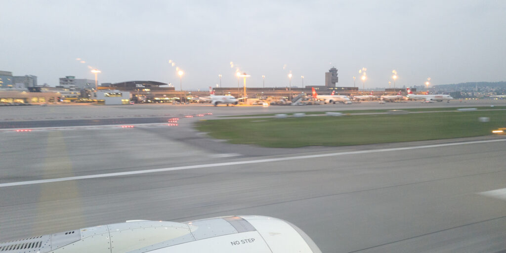
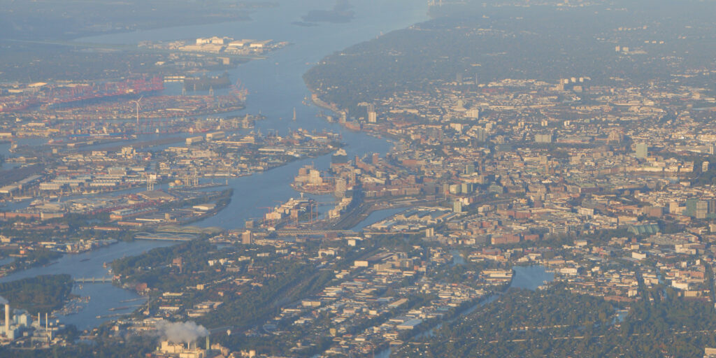
12.10.2021: Today was a historic day. For the first time in 593 days, or one year, eight months and twelve days I have again been on a commercial airliner, flying to Hamburg to attend the Intelligent Transport Systems Conference. As can be see below, I haven’t lost my habit of getting a window seat…
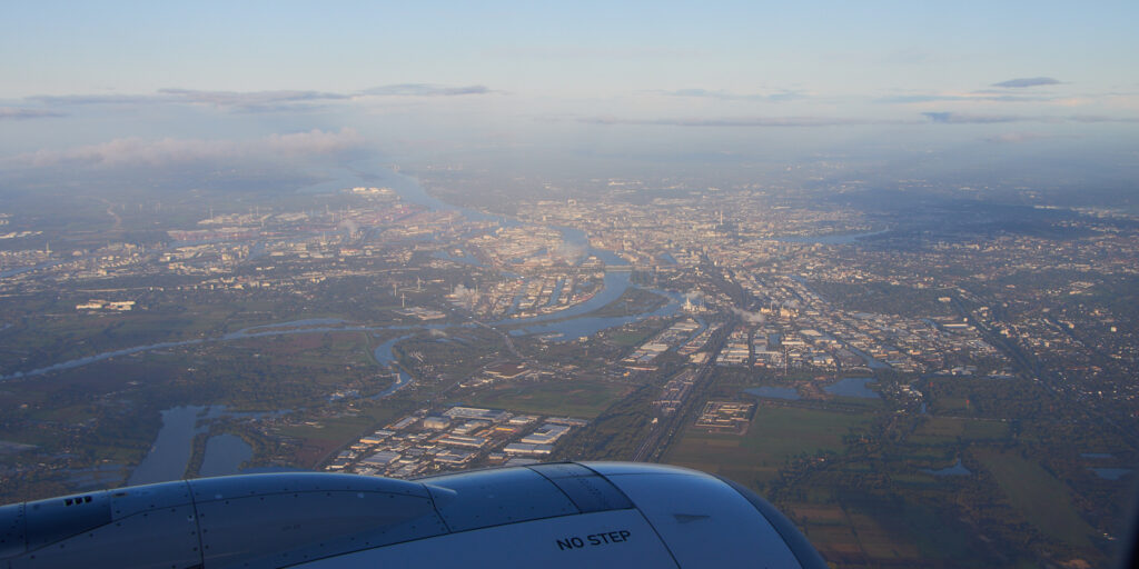
The weather was very nice when we approached Hamburg and we landed in a westerly direction, so I had a nice view at the city.
We spent a few days in Hamburg in September, nice to see the places we had visitied from above.
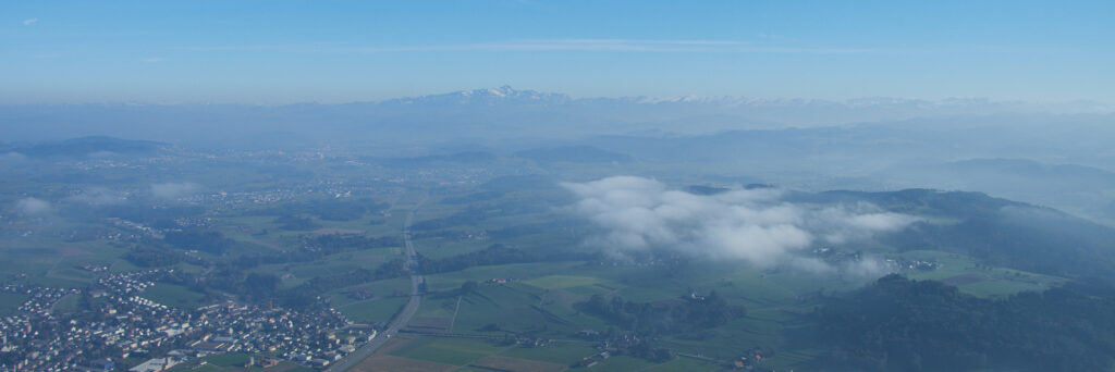
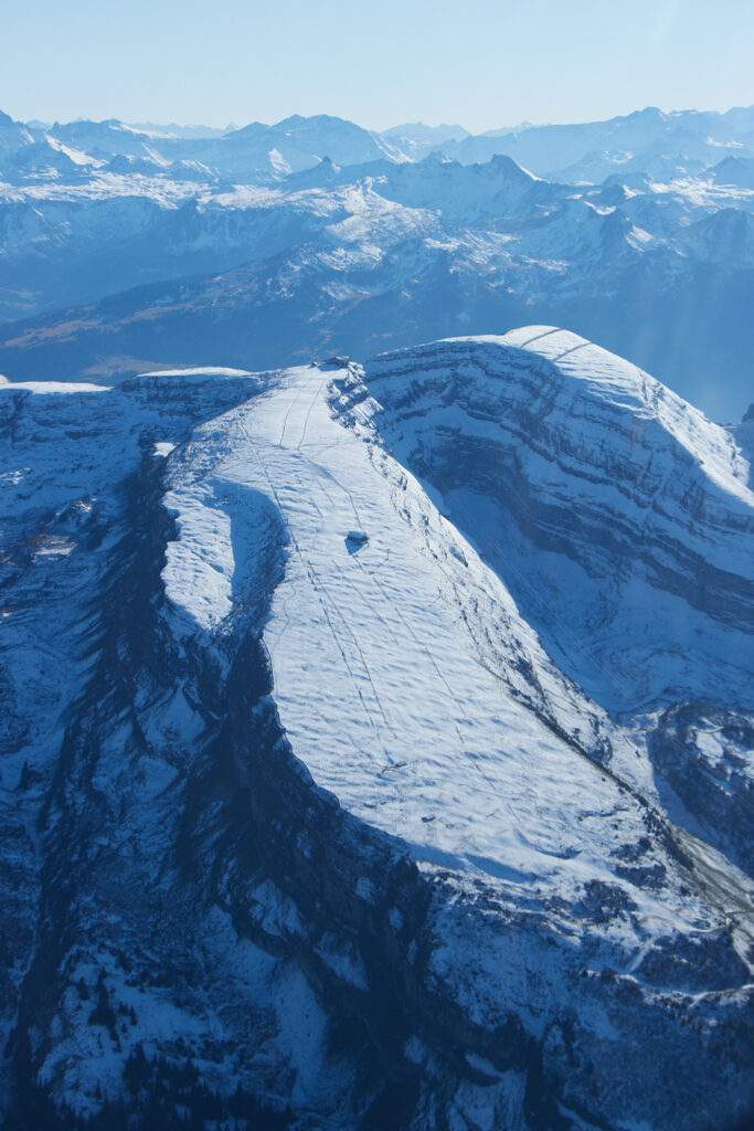
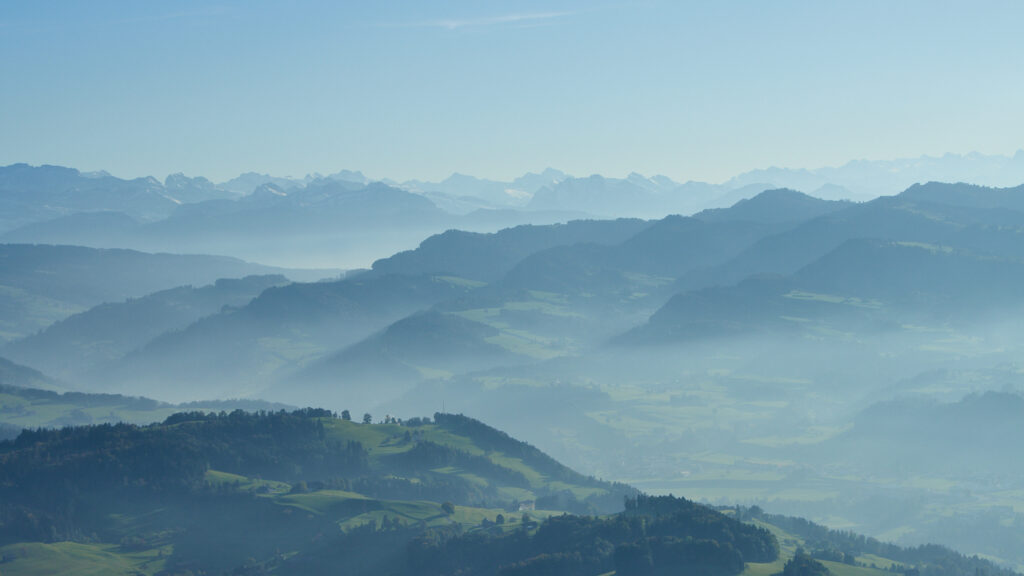
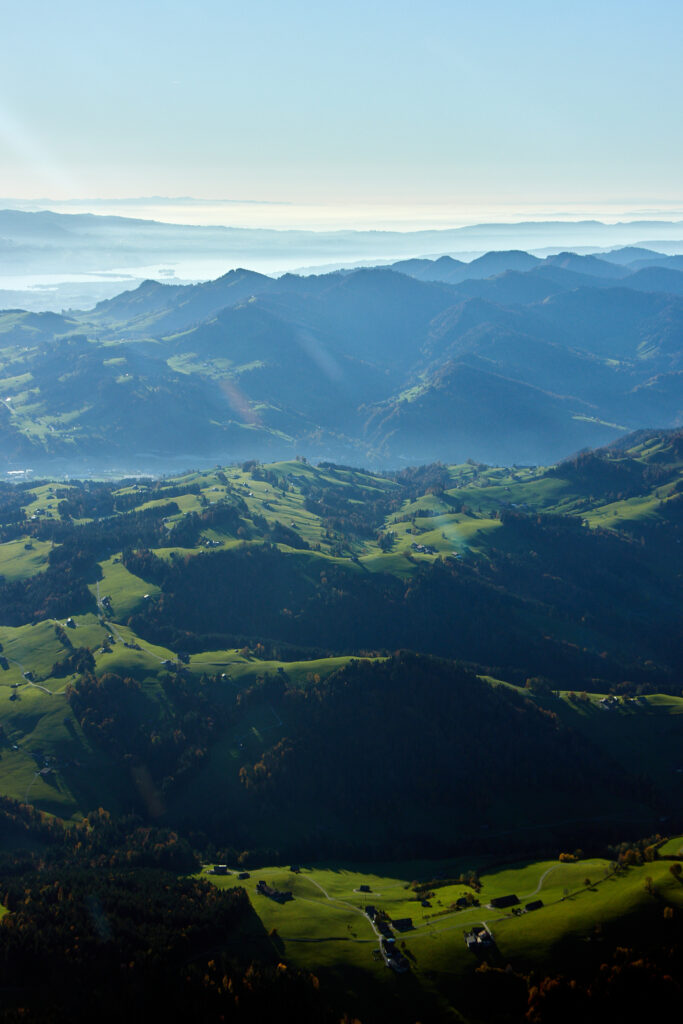
17.10.2021: Another chance to go flying today, this time with perfect flying weather. And on top of that there has been some snowfall in the mountains yesterday, which I wanted to check out. I took off around 15:30 local time, heading as usual south towards the moutains. As usual there was some haze first, but the higher one climbs the better visibility gets.
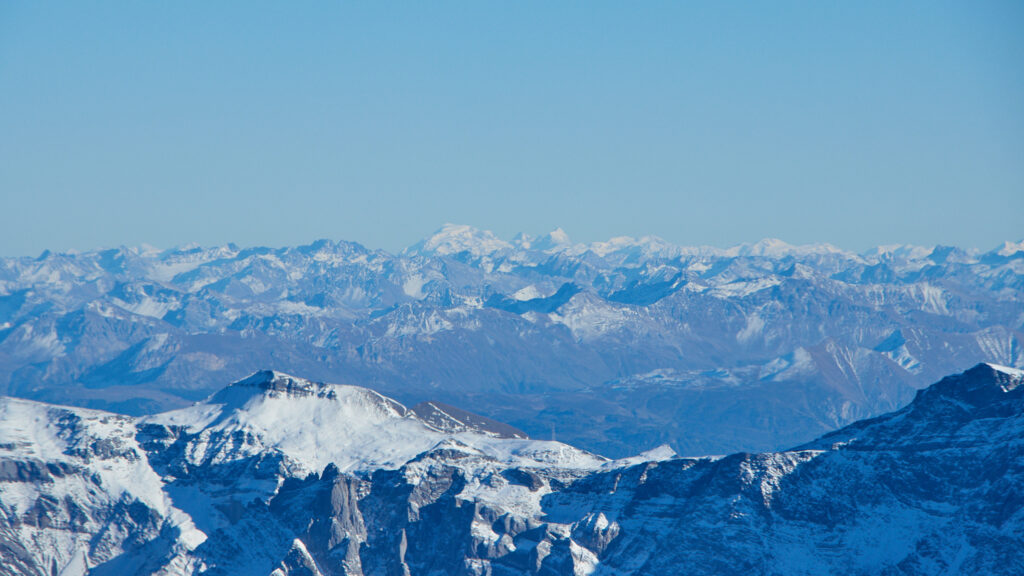
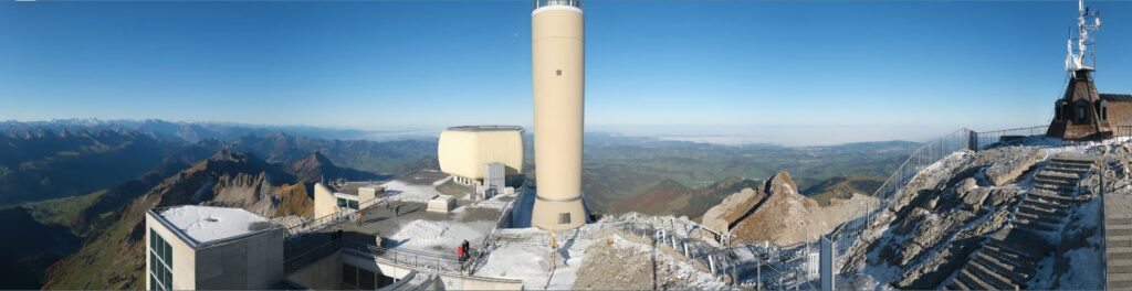
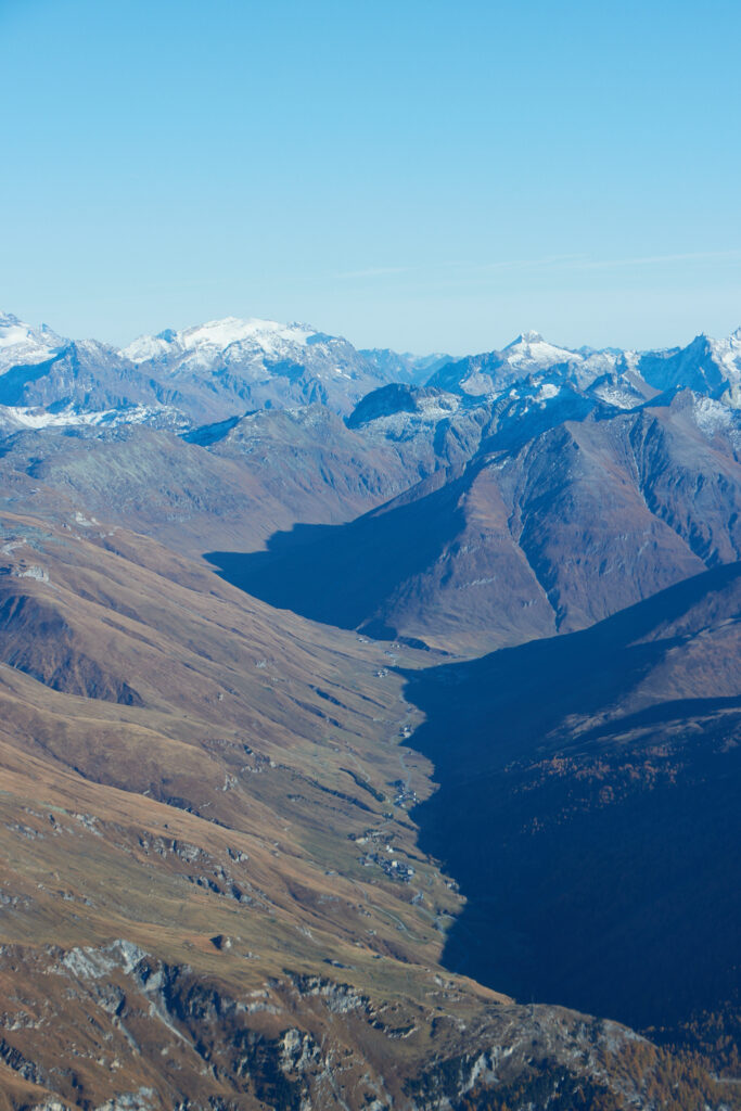
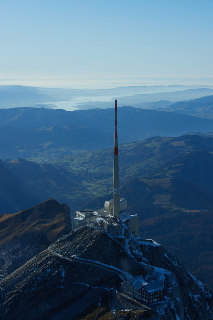
Approaching the Säntis I took a quite spectacular picture with my mobile phone, which is shown below.
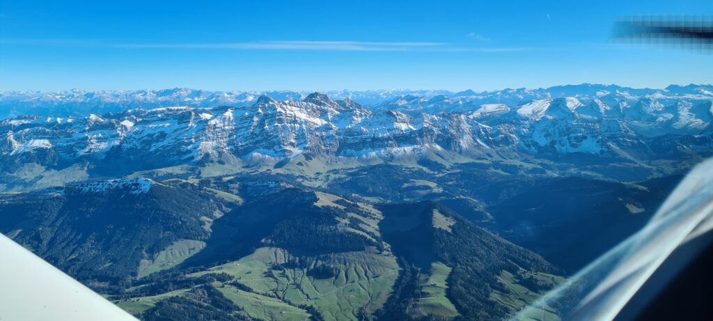
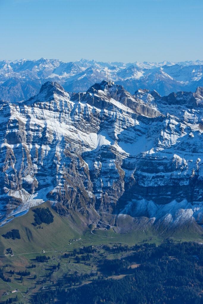
Unfortunately there is the propeller sticking into the picture on the upper right side, and there is also the canopy frame with some reflections on the lower right side. Finally, there is a slightly blueish colour shift, resulting from the tinted colour of the canopy. All these items are ignored by the human eye when enjoying the senery, but stick out prominently in a picture taken by a stupid camera. So I took this picture as an example of what can be done with Capture One, or other raw file editors, in order to better represent what the viewer has seen. The resulting panorama pictureis shown below, where the horizon has been levelled, the propeller removed, the picture cropped to eliminate the canopy frame and wing and the white balance corrected.
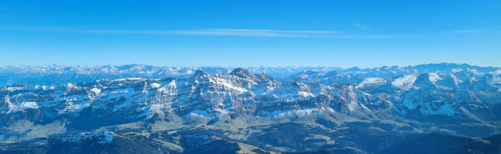
That’s about as far as I go with picture editing, anything more would in my opinion be faking the content.
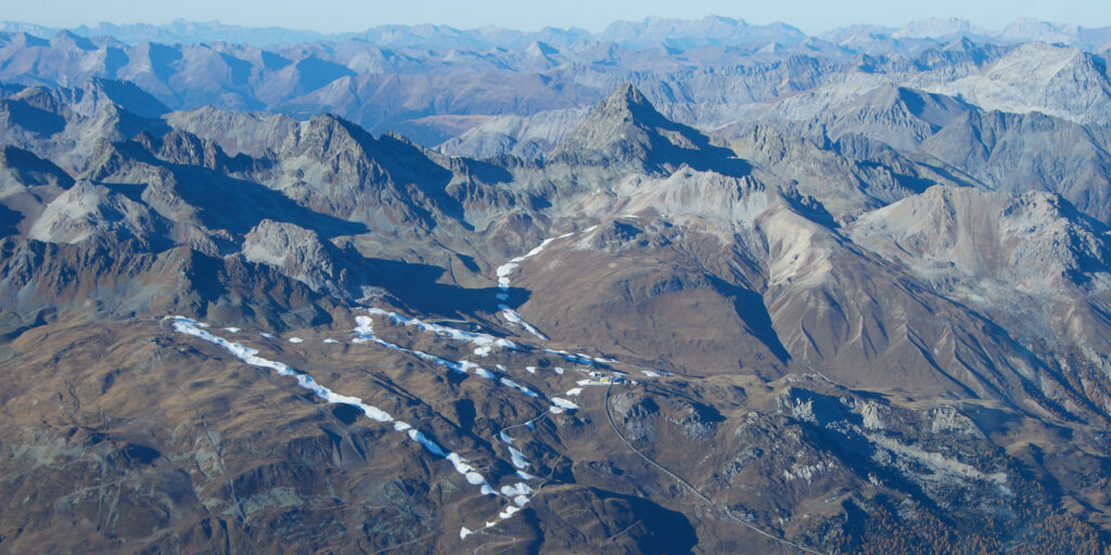
The closes skiing are from where I live also showed a thin layer of snow, but that’s probably gone again in a few days.
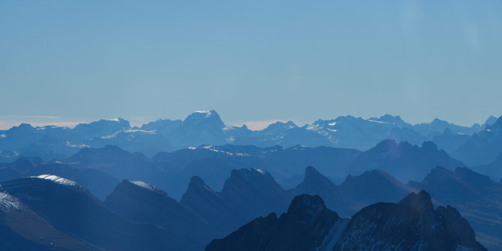
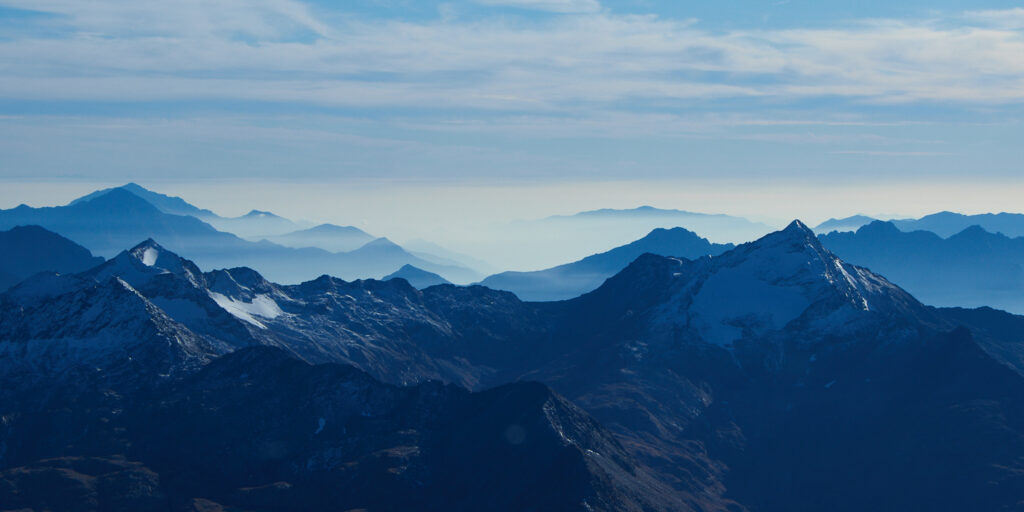
Below the Tödi, which is snow covered all year round.
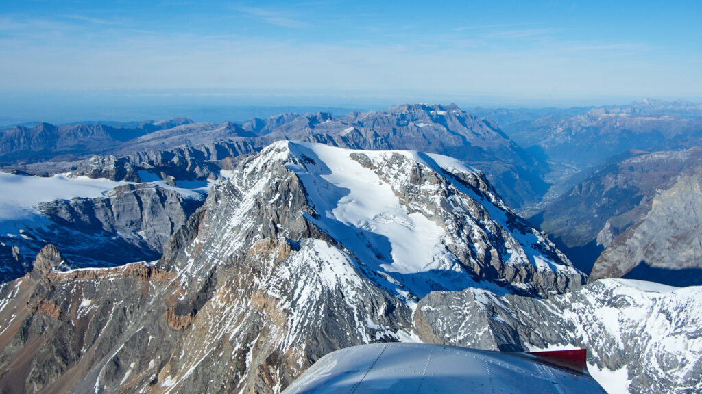
The same applies to Piz Bernina in the far background.
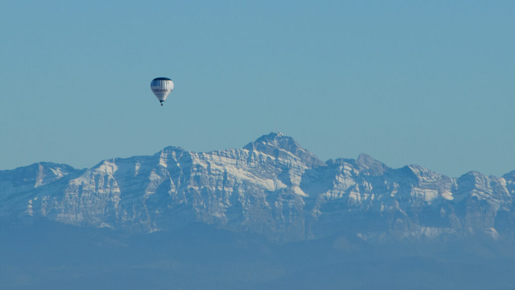
When heading back towards Lommis there was again this nice autumn evening light…
… and looking back I saw that also soem baloon flyers took advantage of the perfect conditions.
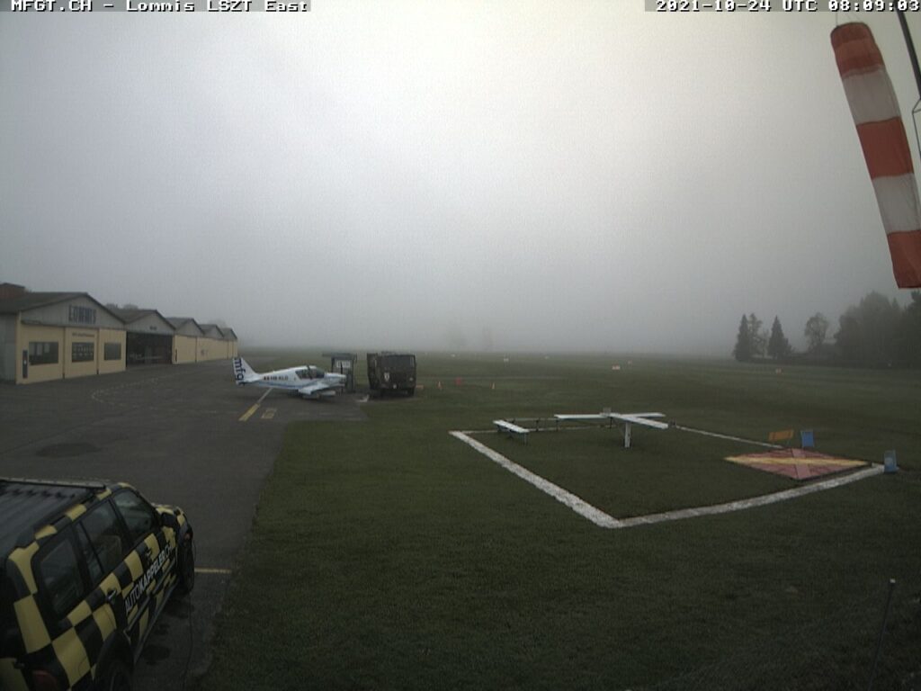
24.10.2021: Another chance to go flying today, again with perfect weather predicted. The only problem was the fog, which persisted at the airfield. Below a picture taken at around 10:00 local time by one of the two webcams in Lommis, which can be checked online under http://www.mfgt.ch.
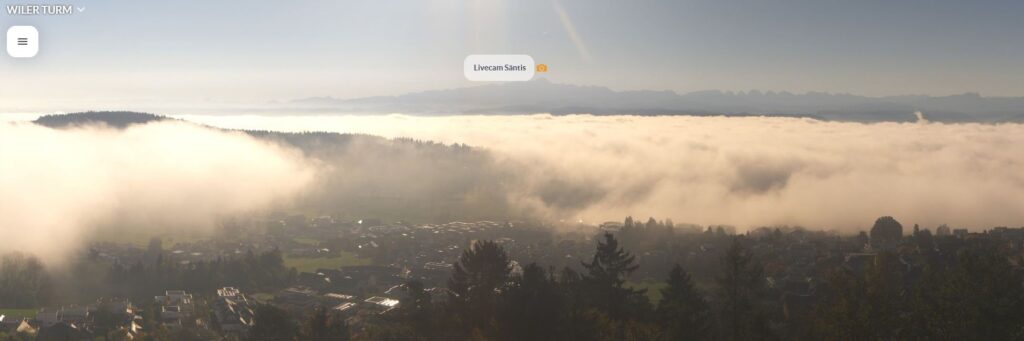
At the same time the webcam on the Säntis (https://saentis.roundshot.com/#/), which is located around 40 km / 22 miles southeast of Lommis at 2’502 m / 8’208 ft, showed an entirely different picture. Lommis is somewhere under the white layer of clouds which can be seen in the background on the right half of the picture.
Even the webcam on the small viewing platform near the city of Wil (https://wilerturm.roundshot.com/#/), which is located only 6 km / 3 miles south of Lommis at 747 m / 2’450 ft, or roughly 900 ft above the airfield, was clearly above the fog. From that one picture can estimate that the layer of fog must have been only around 150 m / 500 ft thick.
But luckily the fog cleared at around 14:00, so off I went.
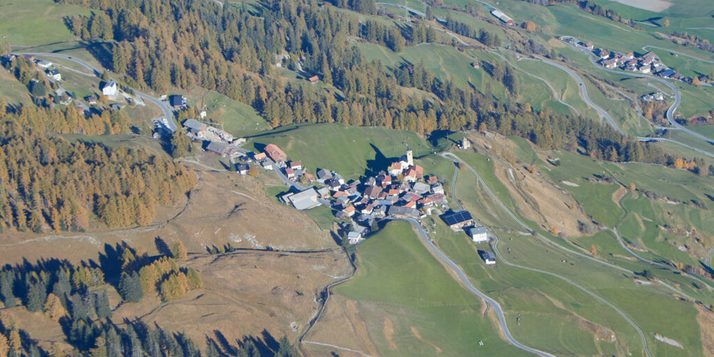
I decided to fly to the Engadin valley to see the larches, which are turning yellow in October / November before loosing their needles. On the way there I passed the small village of Mathon, where i have spent most of my summer holidays as a child. From what I could see the old chalet my parents rented every year is still standing.
I then continued up the Avers valley,…
…from where I had a nice view south into the Po valley of northern Italy, all hidden under a layer of mist, fog or smog, or a combination of the three.
I then crossed into the Engadin valley near Maloja. And indeed, the larches, which make up a large part of the trees in the Engadin valley, were all yelllow.
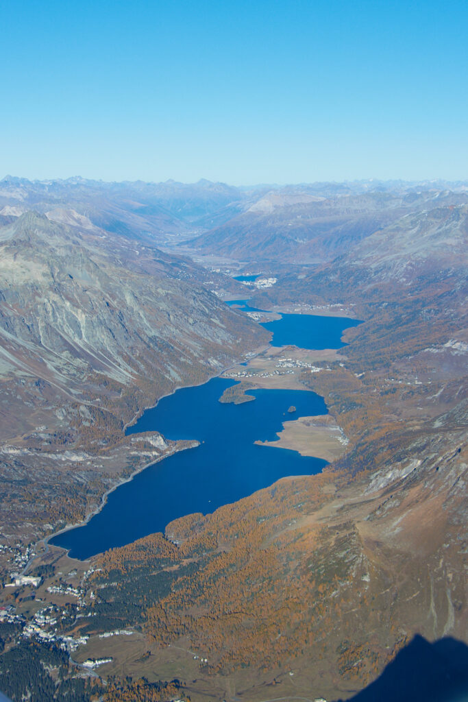
I continued past Piz Bernina, with 4’049 m / 13’284 ft the highest mountain in the eastern part of the alps, and the only one higher than 4’000 m.
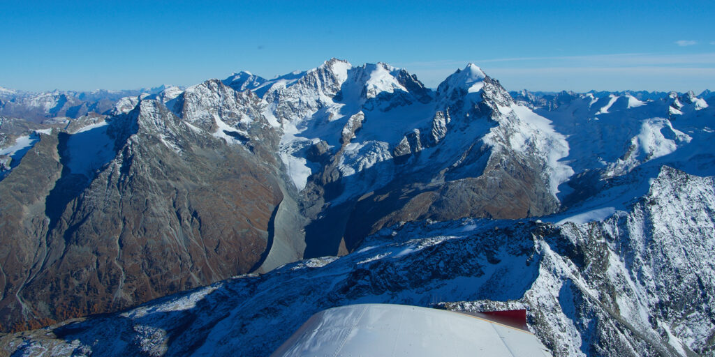
On the opposite side of the valley lies the skiing area of St. Moritz, where some first attempts seem to have been made to create snow, but with limited succes. That’s not a surprise, as my Dynon EFIS indicated an outside temperature of 5 degrees C at FL115.
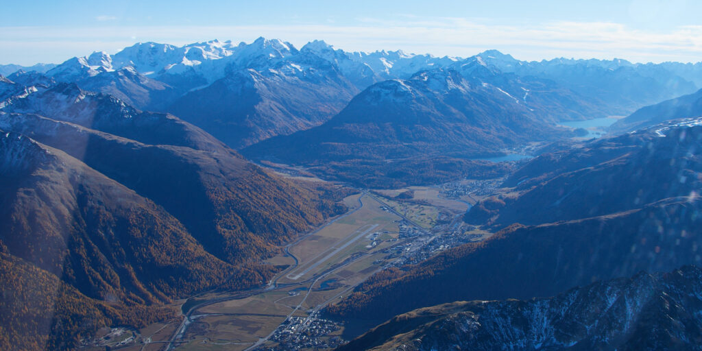
I continued past Samedan airport, which can be seen below with Piz Bernina in the background, before turning north again.
I then selected Lommis as goto-destination and activated the autopilot, leaning back to enjoy the scenery and the calm air.
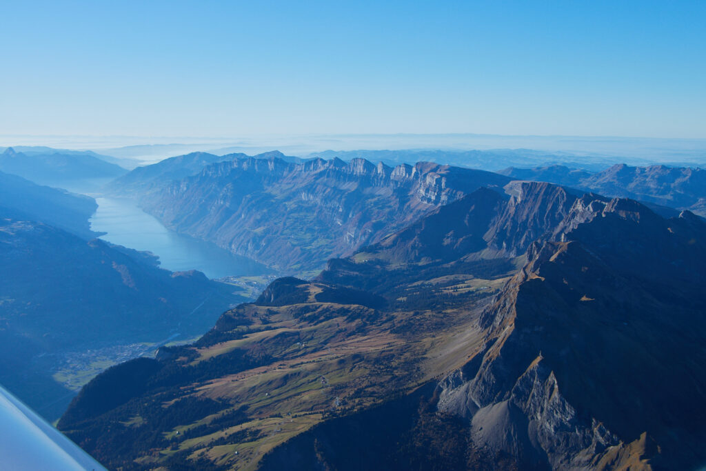
I flew back all the way past the Walensee and the Churfirsten mountains at FL105, before starting my descent towards the Säntis.
Any sign of the fresh snow I saw one week ago was gone, again not to my surprise.
A last view west, with unusually bright green colours thanks to the already quite low sun, before landing in Lommis.
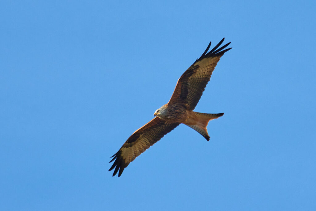
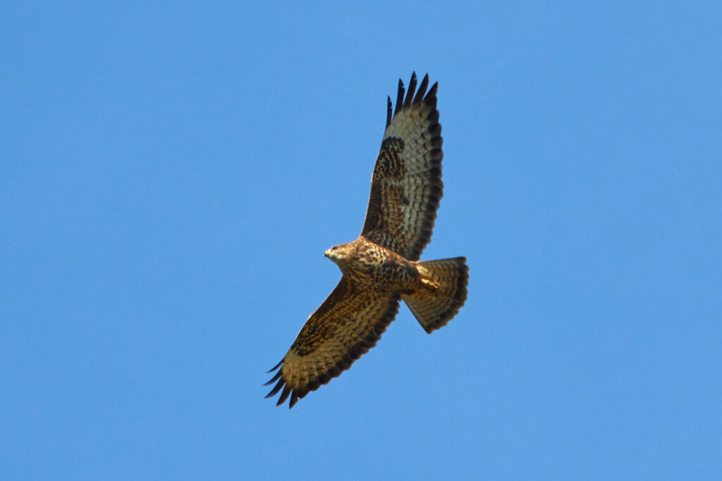
31.10.2021: When we were hiking today along the Rhine river I noticed two birds of prey circling above us. I had the impression they were enjoying flying as much as I do. Luckily I had my camera with me, so I could take some nice pictures.
The first of the two birds was a common buzzard (1.28 m wingspan / 1.3 kg), of which there are many in Switzerland (around 15’000 to 20’000 breeeding couples).
The second one was a red kite, after the bearded vulture (2.8 m wingspan / 7 kg) and the golden eagle (2.25 m / 6.7 kg) the third largest native bird in Switzerland (1.65 m / 1.3 kg). Red kites have been pretty rare thirty years ago, but the population has grown rapidly since then, reaching around 3’000 breeding couples.