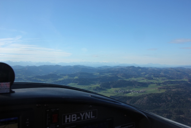
01.11.2015: The weather forecast for today was predicting persistent fog in the plains with only a partial chance of breakup, but perfect views above due to very low humidity (20%). This means extreme visibility, they predicted > 300 km even from mountains which are only around 2’500 m / 8’000 ft high. That was of course enough to make me go for it, this time with my older daughter.
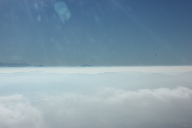
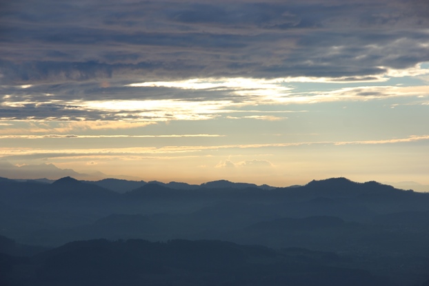
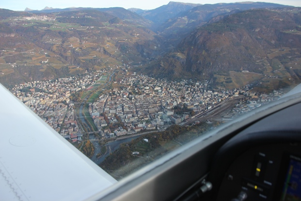
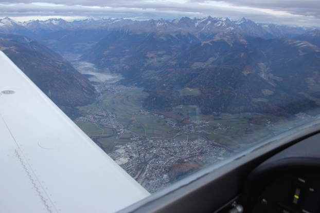
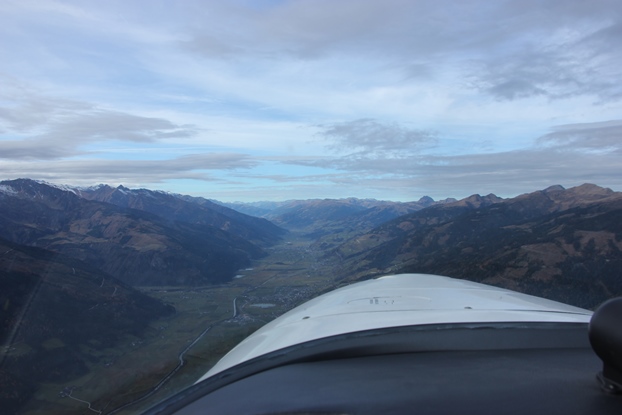
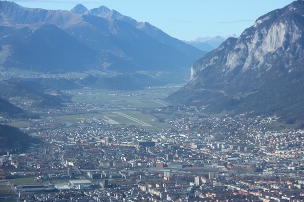
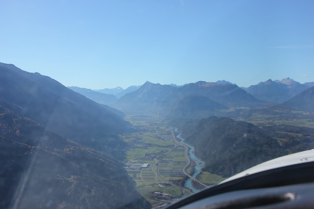
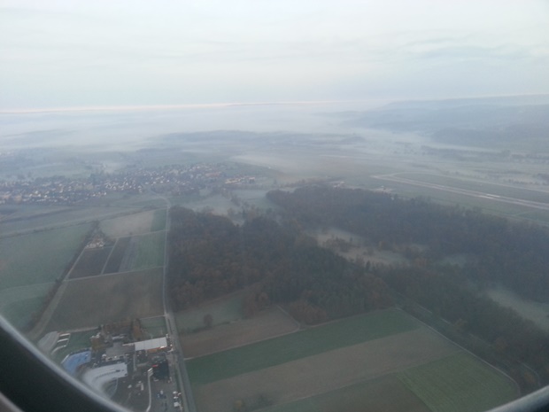
When taking off after 14:00 local time we found sufficient visibility for an easy departure, but there was still a clear layer of haze over nearly the whole country, as can be seen below, even though not very thick with an upper limit of around 3’500 ft.
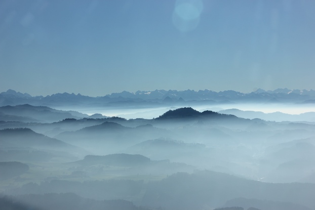
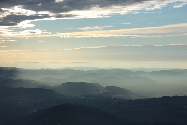
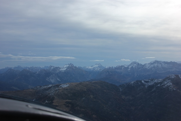
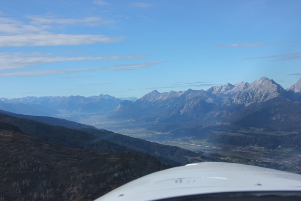
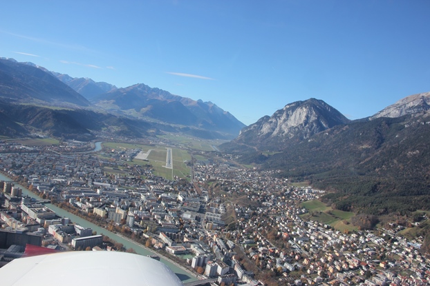
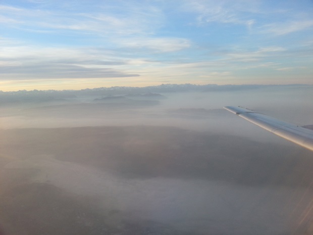
Toward the foothills the haze got thinner, but that did not matter as we were already above. The predicted visibility seem correct, we could see Mont Blanc shortly after departure and that’s a distance of about 320 km.
Also temperatures were pretty extreme, 12oC on the ground but 17oC in 5’000 ft.
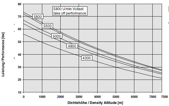
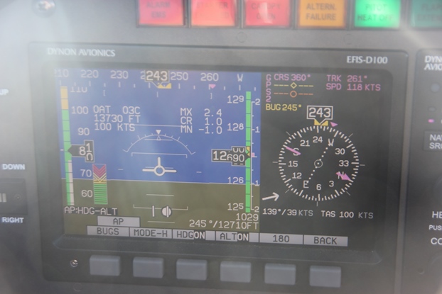
Even in 12’700 ft the temperature was still +3oC degrees, so the density altitude was 13’730 ft. Note that even though the indicated speed was only 81 kts, the true airspeed was still around 100 kts. That’s not bad for a 73 kW / 100 hp engine, which according to the Rotax manual only has a maximum power output of 28 kWh / 38 hp at 7’500 ft. Extrapolated to 14’000 ft the maximum power drops to around 11 kWh / 15 hp at 5’800 rpm or 9 kWh / 12 hp at 14’000 ft.
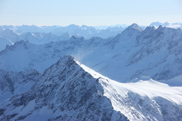
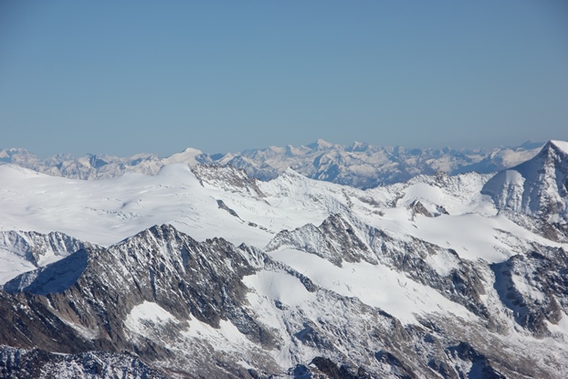
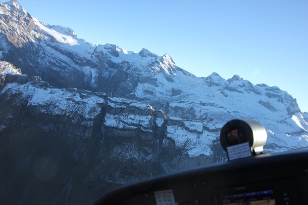
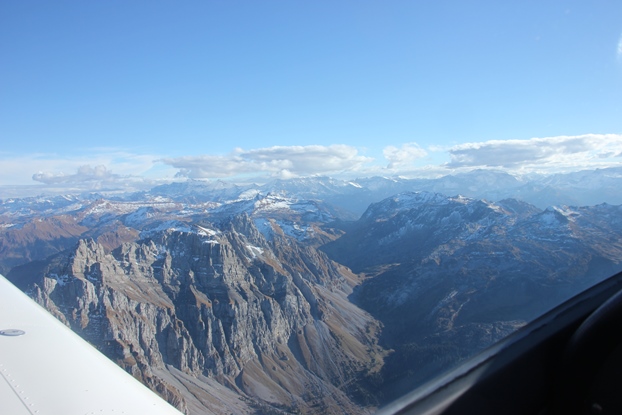
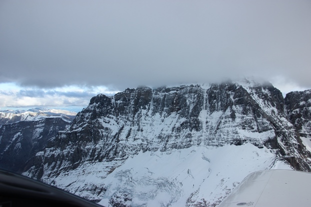
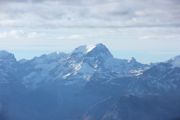
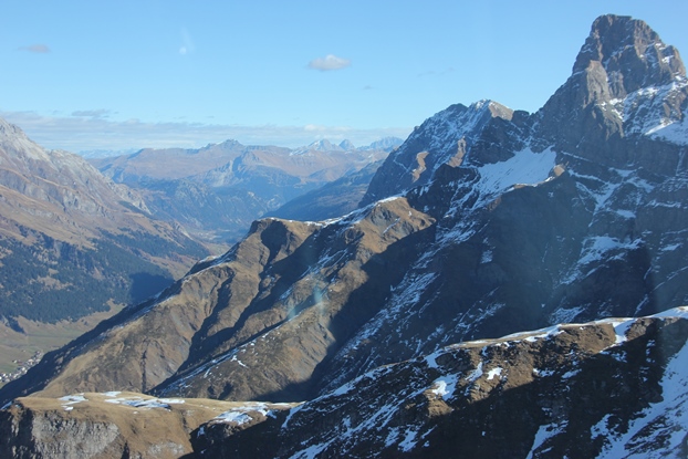
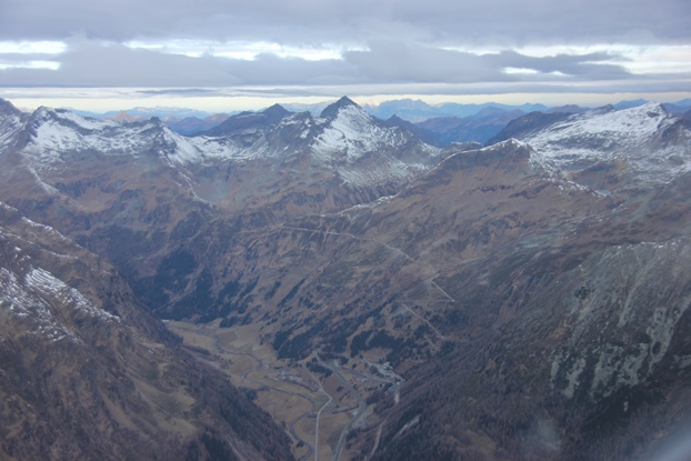
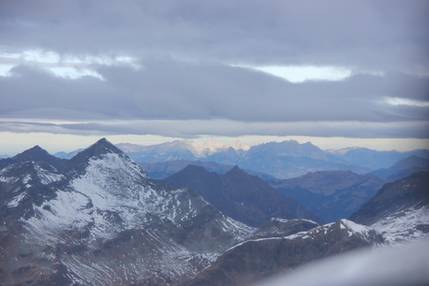
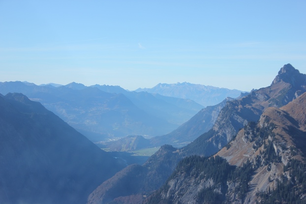
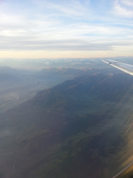
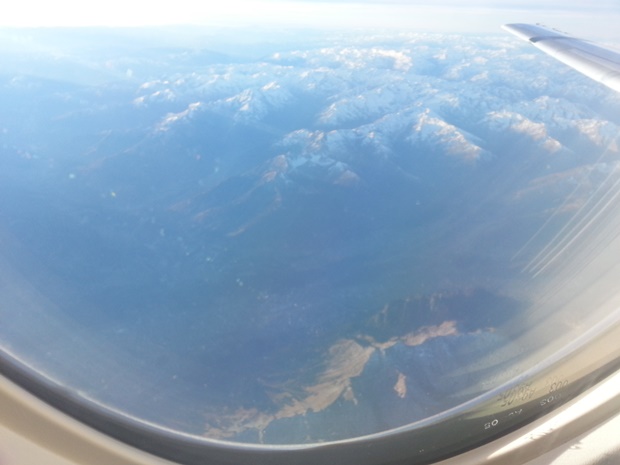
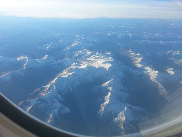
There was a layer of fresh snow on all the north facing slopes, thin enough to still nicely show all the contours but thick enough to give a wintery look.
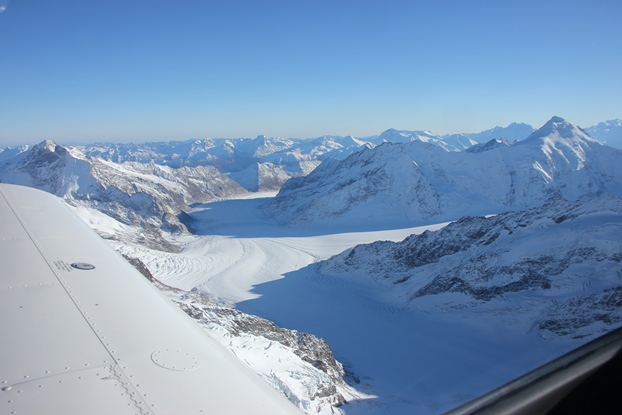
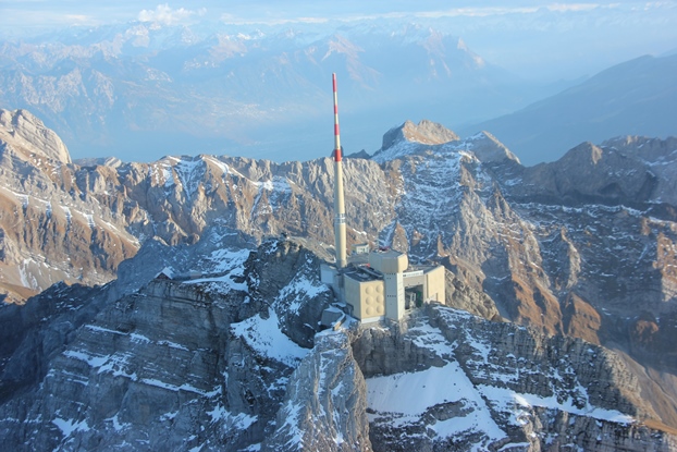
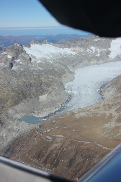
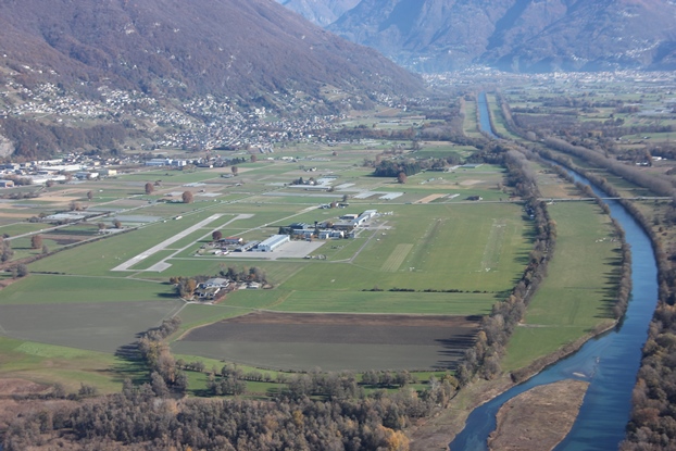
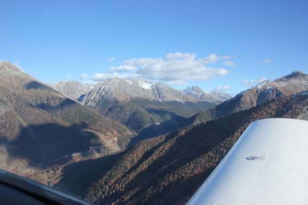
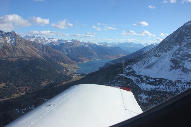
In 12’000 ft there was a pretty strong wind form a south-easterly direction, around 35 – 38 kts. This created quite some up and down drafts around mountain ridges, so I decided to approach to the Jungfraujoch, the destination of our tour, from the south. Like that we approached the Joch over the slowly rising terrain of the Aletsch glacier with wind from the back. To get there we flew over the upper part of the Goms, with the airfield of Münster (LSPU) visible below. This is a former military airbase, with a second in Ulrichen (LSMC) visible on the right, which is however closed since 1999 The Swiss air force once had around 20 such airbases, most of them pretty spectacular to fly to even in a small plane, but they operated jets from most of them. Some are now closed, but many are operated by local flying clubs. Münster is mostly used as a base for glider camps, but also open to other traffic (PPR).
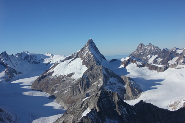
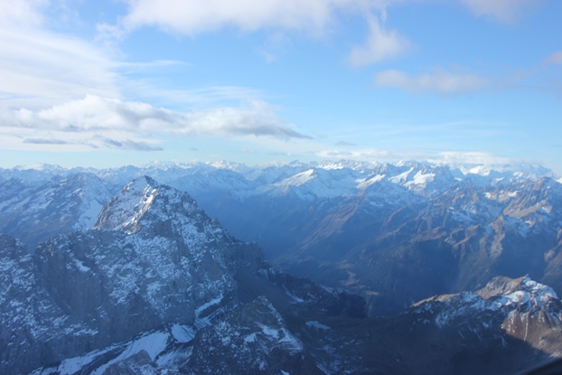
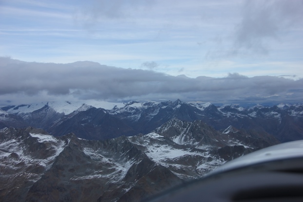
We then turned northwest, flying along the Aletsch glacier, and my prediction proved correct. It was no problem to maintain the more than 12’000 ft, we even climbed to around 13’500 ft before crossing the Jungfraujoch, with these temperatures that was flight level 127.
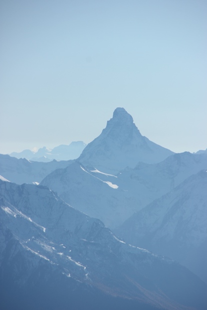
Below a view back towards Matterhorn, always a spectacular sight.
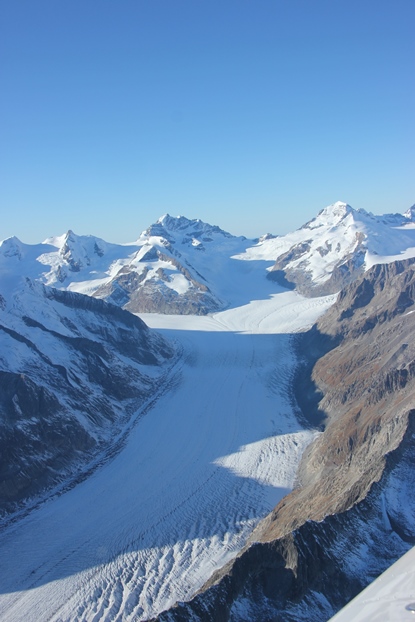
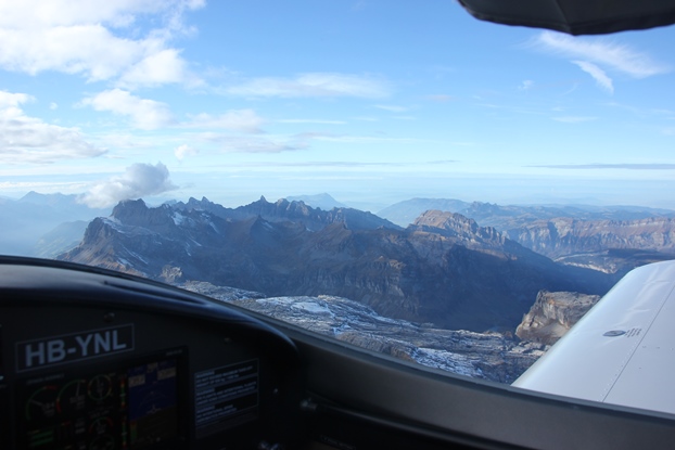
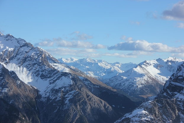
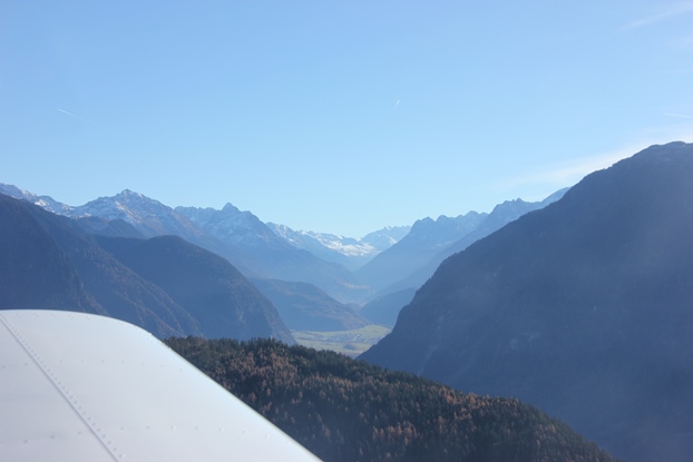
The Jungraujoch lies at the top end of the glacier, with the layer of haze clearly visible behind.
Below a view back toward southwest, across the g Aletsch glacier.
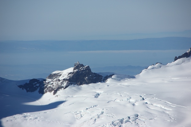
I told my daughter to expect some turbulence and a downdraft after passing the observatory, and was more that right. The turbulence was not too bad, but the descent was around 1’500 ft/min with no chance to reduce that significantly even with full power. If approaching from the south we could never have passed the Joch, which is at around 11’400 ft, requiring at least 12’500 ft of altitude to cross including margin.
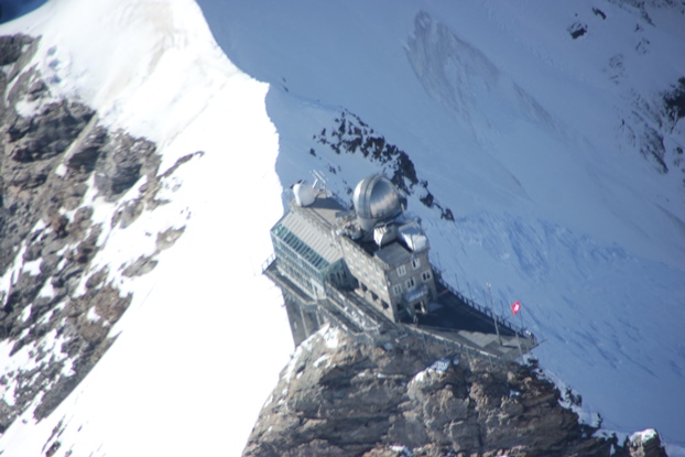
Such a crossing might sound a bit “daring”, but that’s not the case if planned properly. On the north side of the Joch the terrain drops sharply towards Interlaken (where there is still a runway of another defunct military airfield), which lies more than 10’000 ft lower.
Also in case of engine problems there are good diversion airfields nearby, Meiringen airbase in 22 km distance at 1890 ft and Thun airfield in 37 km at 1850 ft. To Meiringen that’s a drop of 3’200 m / 10’000 ft, which means a gliding angle of around 7 from the Joch, even a stone could nearly get there. Looking south, Münster is around 24 km from the Joch, at 4’360 ft, which is still within gliding range in no wind condition. With winds as today the two airfields to the North would be preferable. When flying in the mountains I always keep trace of where the next airfield is, and also where emergency landings would be possible.
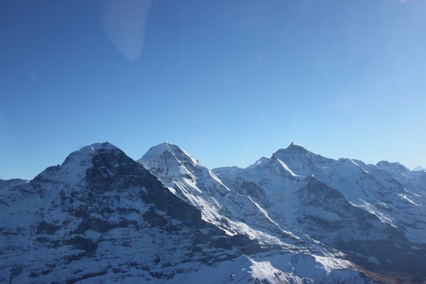
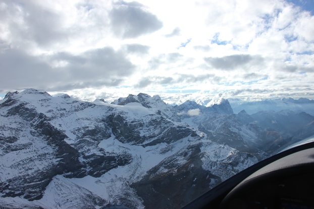
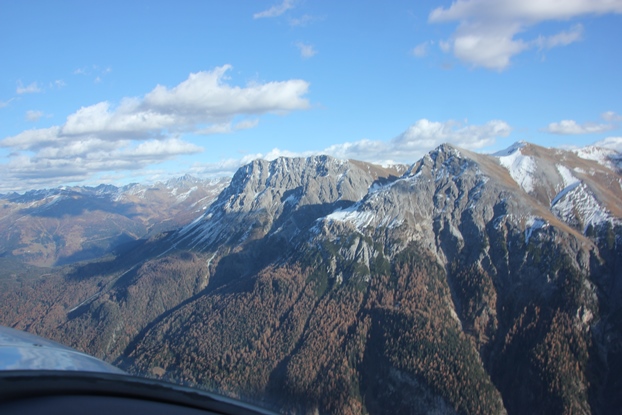
After passing the Jungfraujoch we turned east, passing the Eiger north face, but keeping a safe distance due to the turbulence.
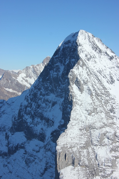
Below a look back at Eiger, Mönch and Jungfrau.
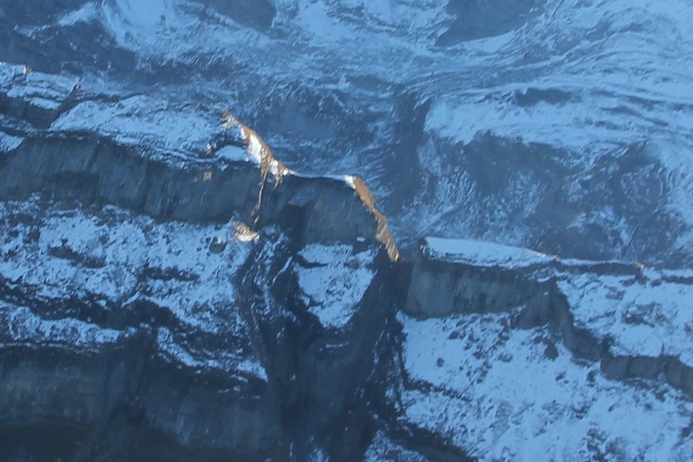
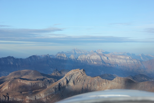
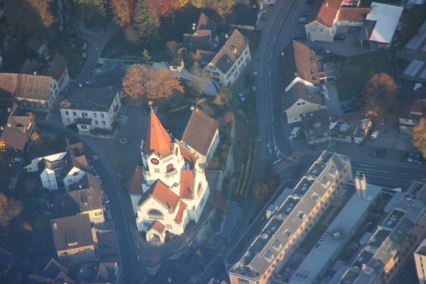
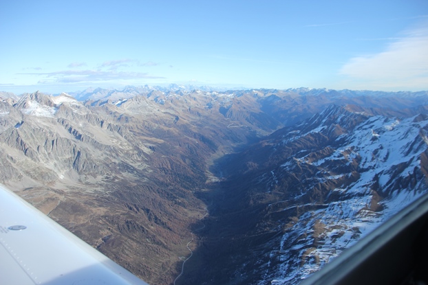
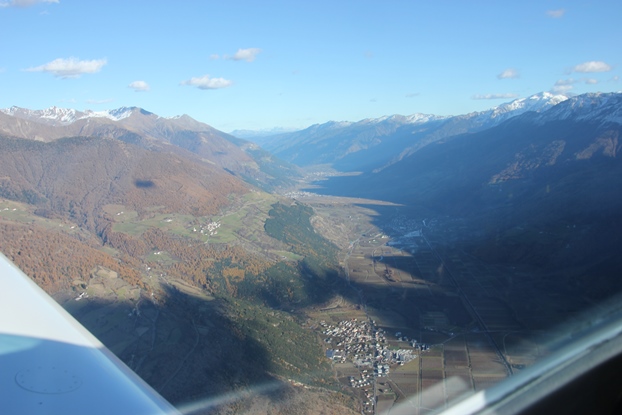
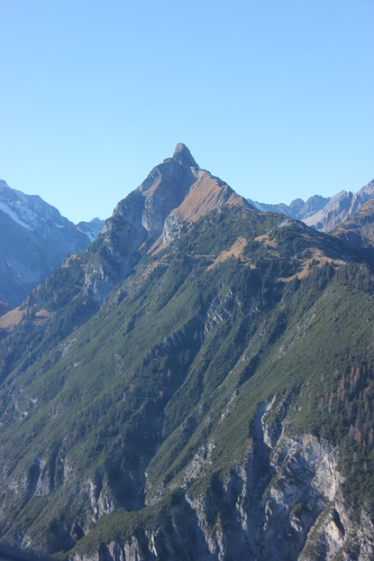
We then turned back towards Lommis, more or less in a straight line. By doing that we passed the “hole in the mountain” again, that I had first seen in September, as shown below. It’s less easy to spot from higher altitude, as there are always rocks behind it, only when there is a patch of snow behind it becomes briefly visible.
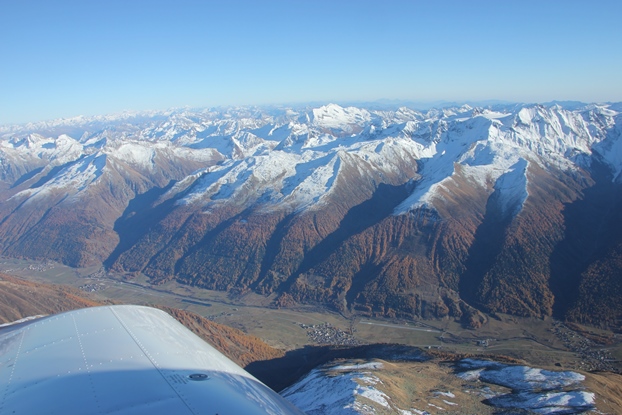
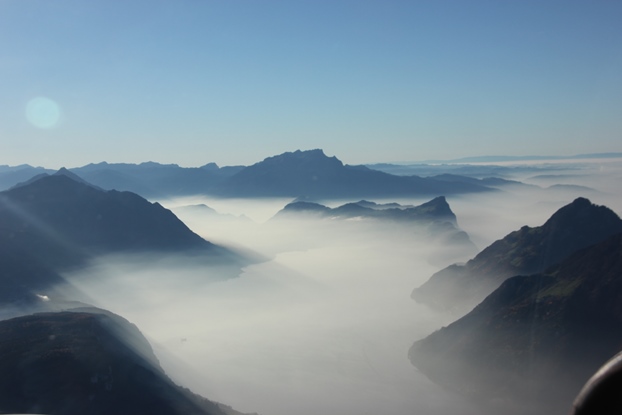
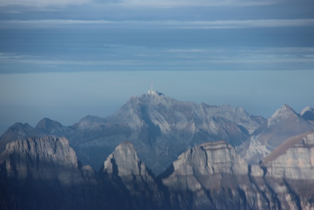
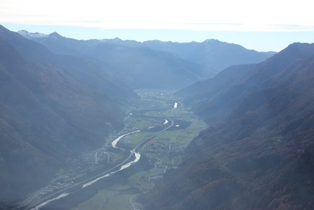
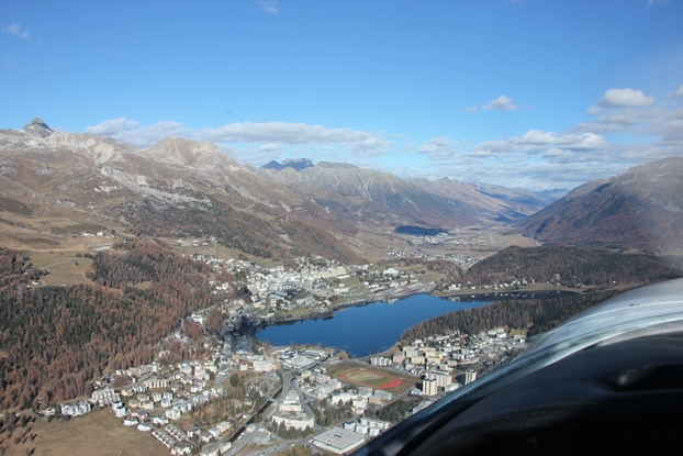
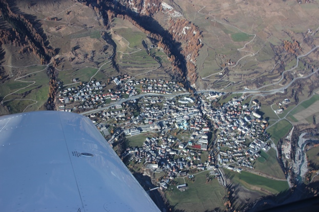
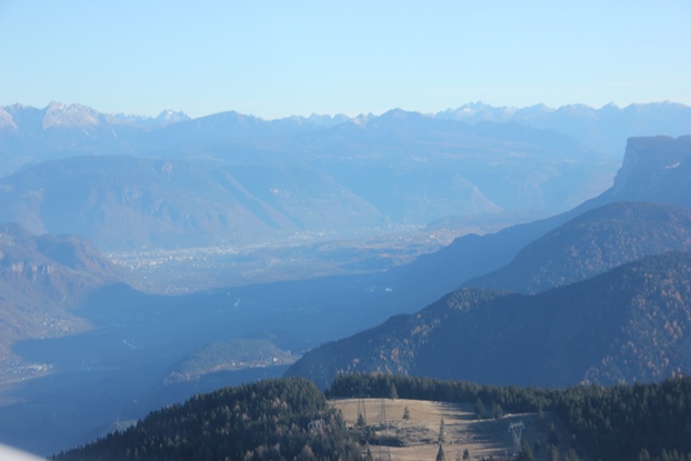
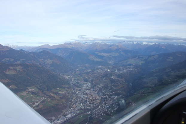
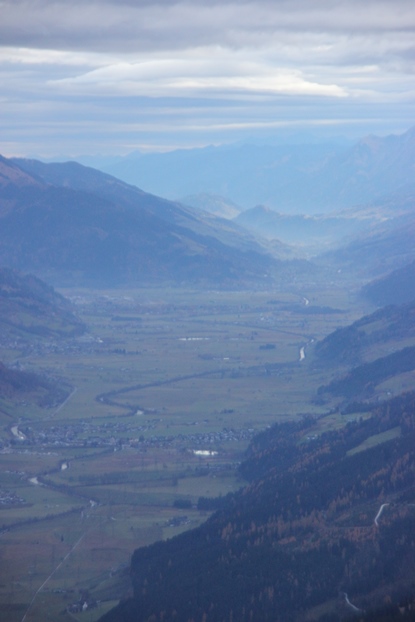
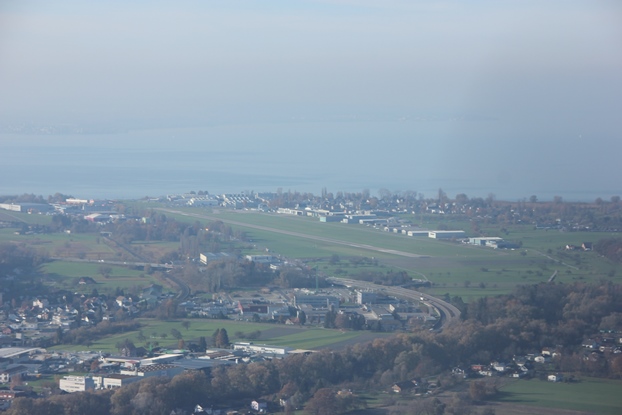
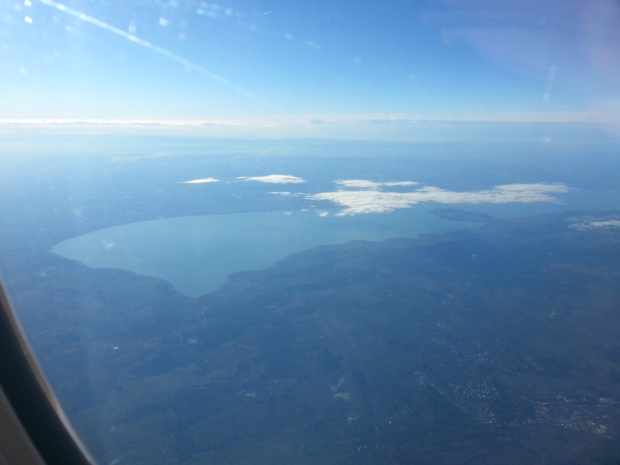
Getting closer to the plains the haze came back, below the Lake of the four cantons with the Pilatus in the centre and the Rigi to the right
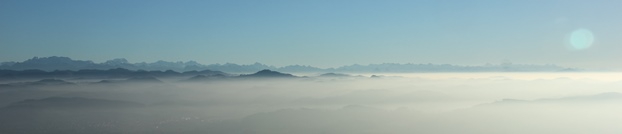
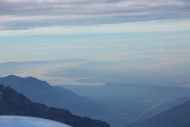
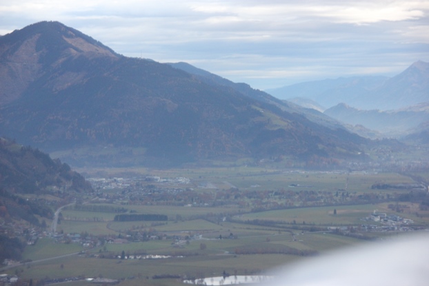
Near Lommis the panorama looked like this, just amazing. Again, the mointain at the far end on the right side is the Mont Blanc, which is around 320 km away from Lommis.
The tour took us a bit more than two hours, but with some detours to look at various sights along the route.
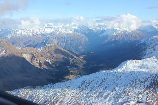
04.11.2015: The flying season seems to come to an end soon, so I’m taking every chance to go flying. Today was one of them, as I had a day off, so off I went with my younger daughter. In the north-eastern part of Switzerland the weather was very nice, but there were more and more clouds the especially in the western alps.
I had the intention to fly to the Jungfrau again, but then we decided to head south instead due to the clouds. That did not really matter, as there are mountains everywhere…
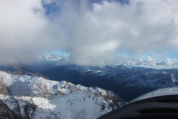
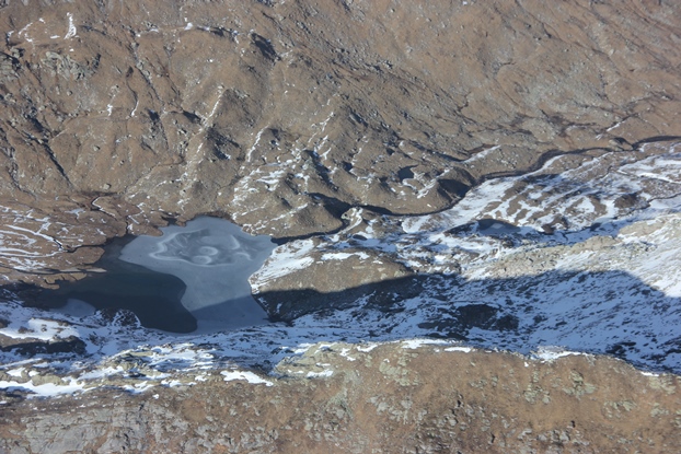
Near Airolo we saw a small lake that was already partially frozen over, at probably around 2’500 m / 8’000 ft AMSL, definitely a sign that winter is coming even though there is still very little snow.
As the weather did not look too nice towards the west we turned east.
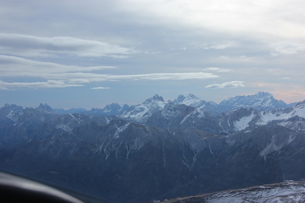
Near Disentis we turned north again, flying at around 12’000 ft under a spectacularly looking cloud layer past the Tödi.
Continuing north with the Säntis as an aiming point all traces of snow disappeared, largely also because we now had the south facing slopes ahead of us.
Below to the left the Lake of Zurich…
…to the right the Säntis.
Even though it was only around 16:15 the sky already started turning reddish….
…which meant that also the colours of the forests go even more spectacular.
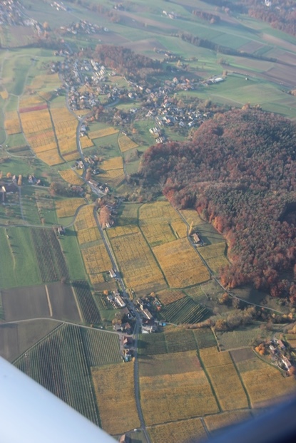
I noticed that the autumn colours don’t only show in the forests, but also the vineyards which are turning to a beautiful yellow.
We landed back in Lommis at around 16:35, with the sun already pretty low, and by the time we had put the plane in the hangar it was already sunset.
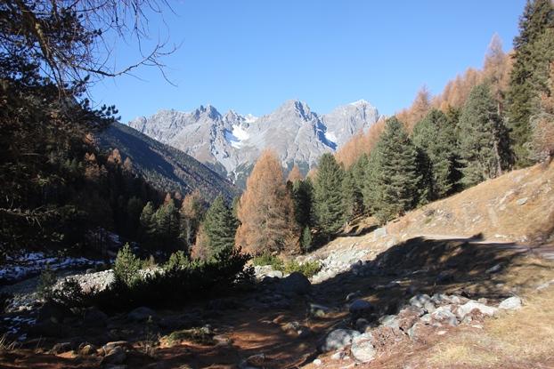
07.11.2015: Back to the mountains, but for once on ground level. We went hiking two days in the Swiss National Park, as the weather is unusually warm for the season and as there is practically no snow. The colours of the trees are as beautiful from the frog’s perspective as from the air.
09.11.2015: A friend and I had planned since long to do a tour to Denmark this autumn, but work schedules, the weather and the end of summertime meant that we had to postpone this to next year. As a partial replacement we decided to do a two day tour south, preferably to the island of Elba, but the weather in northern Italy as well as in the mountains along the coast from Genova to Pisa also made this not possible.
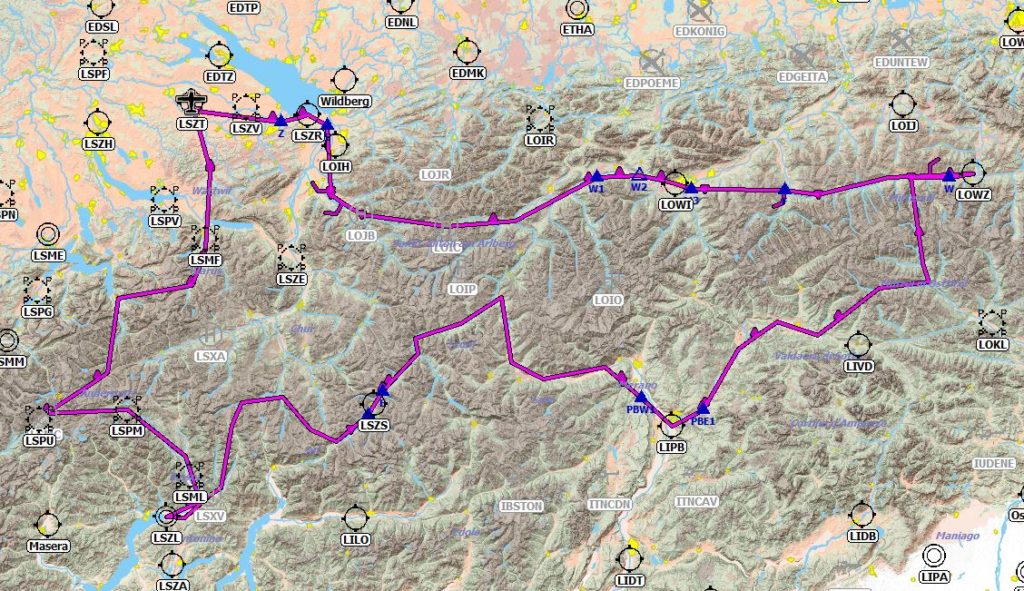
In the alps however the weather looked very good for the two days we had reserved, so we decided to take advantage of this and to fly to Bolzano (LIPB) in northern Italy, with some detours to interesting airports in Switzerland and Austria. The tour we finally did can be seen below, it included stops in Locarno (LSZL), Samedan (LSZS), Bolzano (LIPB), staying overnight, Zell am See (LOWZ), Innsbruck (LOWI )and St. Gallen (LSZR), before returning to Lommis (LSZT).
We took off around 9:30 local time, with a weather one would more associate with spring than with November. The temperature was already in the low 10s, and visibility 100 km+.
We passed the Tödi…
…and climbed to around 10’000 ft heading for the westerly Alps, but noticed that there was a strong headwind of up to more than 30 kts.
We were heading towards the Matterhorn, as can be seen below…
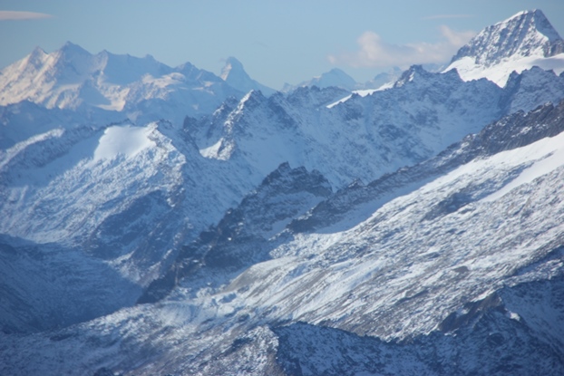
…passing some nice glaciers…
…but then decided to turn south towards Airolo and Locarno, our first destination.
Also the Leventina valley was in full sun, below a view of the military airfield of Lodrino (LSML) whch I have already visited twice.
Locarno was as beautiful as always, with the TMA active which normally indicates heavy military training activity, but there was nobody in the air. We got a straight in approach to runway 26 with clear to land already when passing Bellinzona, which is 12 km away. The runway can be seen on the picture below, that’s really an extended final.
Our intention was to eat a Pizza outside in the nice airport restaurant, but were told on arrival that they are closed on Monday during winter… So not to starve we decided to fly to Samedan, where I was sure the restaurant would be open as it also serves as canteen for the airport staff. We took off after a short stop, again from runway 26 right, and then turned east.
Our route led us over the San Bernardino pass….
…and then past Lago di Lei towards the Engadin valley.
Below the view from Maloja towards St. Moritz, with Samedan airport already visible in the background.
We got a straight in approach again, to runway 03, to which one passes St. Moritz at 7’000 ft and then descends over the hill at the end of the lake towards the runway. No issue for a slow small plane like mine, but I wouldn’t want to do that in a fast business jet of which there are many especially during winter polo weekends.
After landing we saw one of the new Tecnam 2008, this one built in 2015, a very nice plane apart from the limitation that you can’s see outside if you are taller than probably 1m 70 cm.
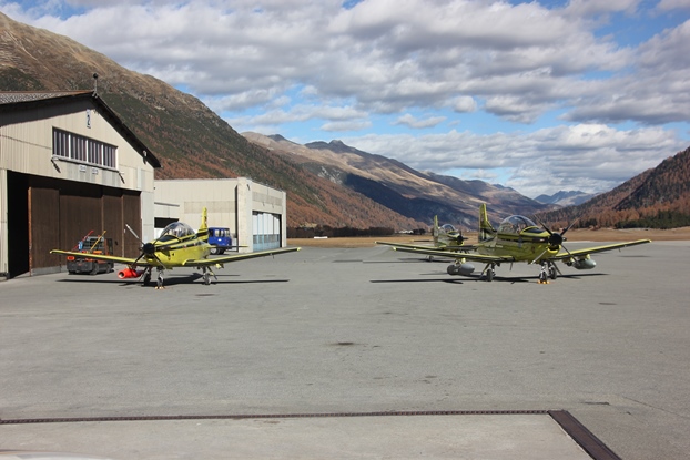
There were also three Pilatus PC-9s used as target towing aircraft, an indication that the anti aircraft shooting range east of the airport was active.
The weather was again great, but with pretty turbulent winds. I got informed by the FISO that there would be 10 kt of crosswind, but shortly before touchdown he changed that to 17 kts gusts. None the less the landing went well, but when departing two hours later I caught a pretty heavy gust just after lifting off, requiring some pretty heavy control inputs to keep straight and over the runway.
We then flew past the Swiss national park, were I had been hiking with my wife just two days earlier, with the same spectacular weather and scenery.
Below Scuol, with the hotel were we had stayed two days ago just under the wingtip.
Our route then led us into Austria near Nauders, but only for maybe a mile or two,….
…as we immediately turned south over the Reschenpass towards Mals, Meran and then Bozen. Learning from previous trips in the are we did not even try to reach either the Swiss nor the Italian ATC, radio coverage in the area is just not good enough at low altitudes. But we had filed a flight plan, which was opened by the FISO in Samedan after departure, so all fully on the legal side.
Below the view from around Mals towards Meran,…
…which we passed slightly to the south before heading towards Bozen.
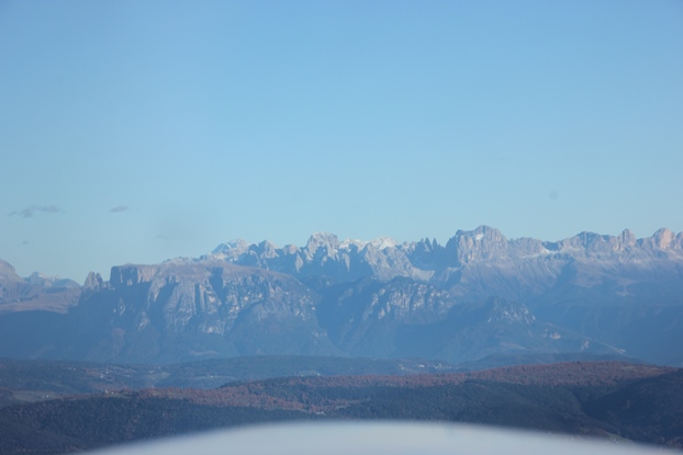
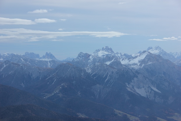
We had a great view of the dolomite mountains east of Bozen, but again with not a trace of snow.
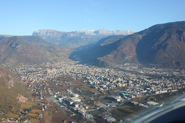
The tower informed me that the main runway was closed (as we learned later since the 24th August for a total resurfacing, not to reopen before the end of November), something I had missed when reading the NOTAMs. This explained the NOTAM regarding unavailability of AVGAS, which I hadn’t missed, as also some taxiways were closed. I also hadn’t missed the NOTAM requesting 3 hours notice for customs, which we did already from Locarno by phone.
They do have a parallel grass runway however, which is long enough for me (01: 652 m, 19: 400 m). The tower let me choose the runway, so I took 01 not because it is longer but because I could fly a normal pattern via the downwind to have a view of the airport instead of an approach straight into the base, which also meant not having to land straight into the already low sun but with the sun from the back.
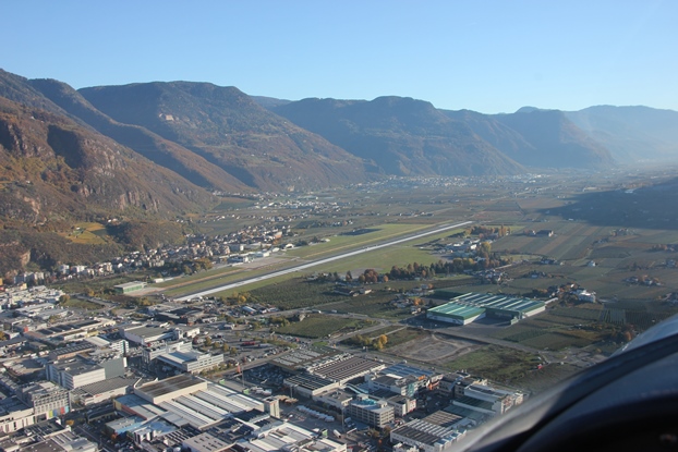
We were surprised about the good status of the grass runway, a very even surface, better than in Lommis. The tower closed the flightplan without asking for it, and even sent a follow me car to lead us to the parking. At the terminal we were amazed to see that all airport service were in full operation, with cafeteria, car rental offices and tourist information counter all staffed. There was more staff than airport users, and that for a landing fee including overnight parking etc. of around 20 €.
A very friendly young lady at the tourist information booked us two rooms in a very nice hotel (pilots rate), and a short taxi ride later we were heading for a beer on a terrace of a small pub.
10.11.2015: This morning we went back to the airport for a departure to Zell am See in Austria. The staff could not issue a flight plan for us, but they let us use one of their computers to do that online. We were even driven to the plane in a golf cart, perfect service again.
Being the only plane at the airport departure was swift, taking off from runway 19 and then turning north towards the Brenner pass.
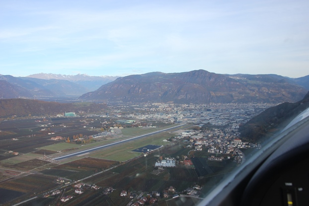
This gave us a nice view of the city centre of the old town of Bozen, really worth a visit. I can only recommend Bozen to every pilot as a destination for e.g. a weekend, it is not too far away, very efficient and friendly service and a very nice town to spend a day and evening.
As can be seen below the weather towards the North was again very nice,…
…but towards the east there were still the clouds from a small front that had passed during the night.
We turned North-East towards Bruneck, and then headed over a small pass into Austria. Again no contact with neither Italian nor Austrian ATC due to poor radio coverage, this time we tried, but without success.
Somewhere in the clouds below must be the Grossglockner, with 3’798 m / 12’461 ft the highest mountain in Austria. We flew at around 11’500 ft, with a wind from the Northwest of 41 kts! Following the terrain to benefit from uplifts that was no problem however, and there was surprisingly little turbulence. I did however reduce the speed to below VA, as one always has to expect sudden heavy turbulence in such conditions.
Towards the North we could see the Mittelgebirge, the mountains forming the Austrian-German border.
We then crossed the Felbertauern pass…
…to descend towards Mittersill, the western approach point for Zell am See.
The airport of Zell am See can be seen below , with the runway in the centre of the picture. Again we got a straight in approach with a “no significant wind” message from the tower which was surprising as we still had 15 kts tailwind when I took the picture. But the tower was right, no wind whatsoever and a very smooth landing.
The seem to have para jumpers here, no sane person would paint a plane like that…
We decided to refuel, as they have Mogas, a good choice as the price of 1.5 € is even lower than it is in Lommis. Again very friendly staff and perfect service. I was told Zell am See can be very busy during the summer, but apart from two motorgliders doing touch and go’s we were the only ones in the air. We filed a flight plan for our next leg to Innsbruck, as it is required to file one in Austria for all flights using ATC.
After departure we turned west, following the valley towards Zell am Ziller.
The further west we flew the better the weather got, with blue sky and no clouds in Innsbruck.
From the approach point Foxtrot we were instructed to fly straight to Mike 3 for a landing on runway 08…
…but when passing Mike 3 at nearly 4’000 ft (2’000 ft above the runway) the tower asked me whether I could land on runway 26 instead. With full flaps and side slipping that was no problem, and to the big surprise of my passenger I still found the time to take some pictures of the runway when doing a side slipping turn to final. Having learned to fly on an old glider has left it’s traces…
Below after landing on the tarmac, only my second landing in Innsbruck and the first one with the SportCruiser. And again as in Bozen and Zell am See very friendly staff, excellent service and only around 20 € landing fee.
My passenger had learned this morning that he could pick up his Kitfox from the paint shop at St.Gallen airport only around 10 days after having brought it there for painting, and of course he could not wait to see it, so instead of flying straight back to Lommis from Innsbruck I proposed to stop in St.Gallen to have a look, which he happily accepted.
We departed west towards the Arlberg pass and got initially cleared for unrestricted climb, only to get re-cleared a minute later to only 5’000 ft due to a Lufthansa Dash-8 arriving in the opposite direction.
Both planes were asked for confirmation of visual contact, and the Lufthansa guys saw us first. They stayed at 6’000 ft, giving safe separation.
After that we got cleared again to climb and soon afterwards left the CTR.
Flying over the Arlberg was as leisurely as it can be, with calm weather, unlimited visibility and not traffic whatsoever. On some skiing slopes we saw rows of white dots, leftovers of previous attempts to produce snow with snow cannons, but with temperatures above 10 degrees the snow piles have melted again.
We approached St.Gallen from the southeast, an approach that I never done before as I normally arrive from either southwest or west.
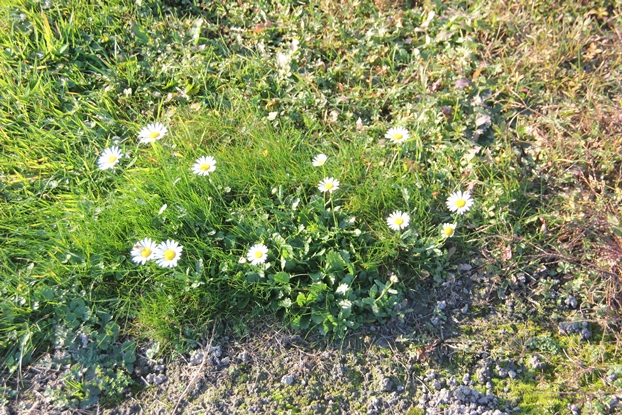
After landing we noticed the flowers blooming, definitely a sign that the weather is playing crazy.
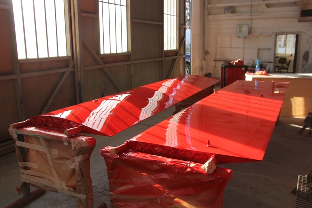
And here it is, probably the first Kitfox in RAL 3020 red, a great looking colour that will definitely make it visible not only in the air but also on the ground.
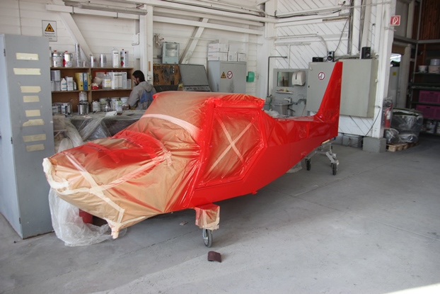
It’s amazing how well the painter managed to make it shine, not easy on a fabric covered plane.
From St.Gallen it was only a short hop back to Lommis, passing the Säntis in slowly developing evening haze.
Conclusions:
This was a great, spontaneous two-day tour through the alps, taking advantage of the spring-like weather. All airports visited provided excellent service, even though we were nearly alone in most places. It seems that many pilots have already mentally closed the flying season, that’s the only explanation I can find why nobody else took advantage of the perfect flying weather.
Total flying time for our little tour was 6 hours 10 minutes (7 hours 11 minutes off block), for a flying distance of around 550 nm. That’s 89 kts average, which is not bad considering the many climbs to fairly high altitudes, many stops, difficult terrain and some very significant winds (mostly headwinds or winds from the side), up to 41 kts.
The season is definitely coming to an end now, and the replacement of all rubber hoses is due, so I might soon ground the plane so that I can start with the work. I will first remove all hoses to see what I need, then order the necessary material and then install the new hoses at a later date. As a result the plane might be grounded for maybe two months, depending on availability of the material and other obligations.
11.11.2015: One of the reasons why I considered flying to Elba too risky was not to get stuck there, as I had to do a short, but important business trip to Budapest today. And as can be seen below the typical autumn weather was back today, with fog in the morning that might or might not dissipate during the day.
On top of the fog it however still looked as nice as during the last two days, with great visibility.
I chose a seat on the right side, so I could see the mountains as the flight to Budapest normally goes along the northern edge of the alps. This proved to be correct, we actually passed just a bit north of Innsbruck, with a great view of Innsbruck airport and the mountains we overflew during the last two days. I had to take pictures with my mobile phone, an against the morning sun, so they are not as good as what I could see by the eye.
The Grossglockner, the highest mountain of Austria, which was hidden in clouds yesterday was now fully visible.
Below the Balaton, always a sign that Budapest is near.
20.11.2015: Another business trip to Berlin, this time out and back in one day as I could not travel the evening before. Its the season again where one is happy to escape to the sun for an hour, and where spectacular clouds can be observed.
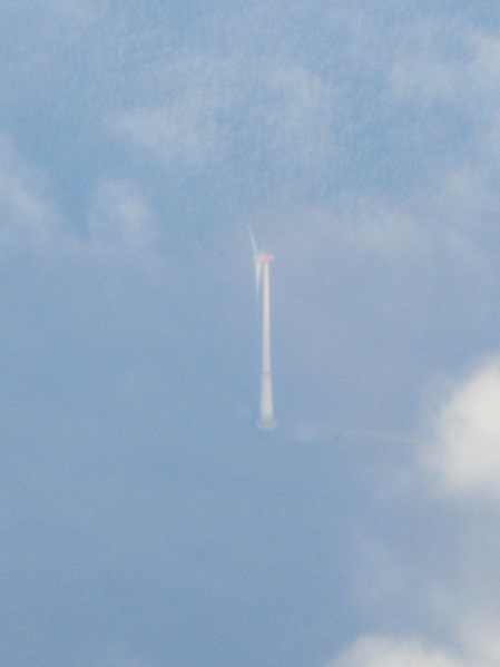
Heading north the weather got better and better (it was raining in Zurich), I could see some spectacularly large windmills from probably around FL290.
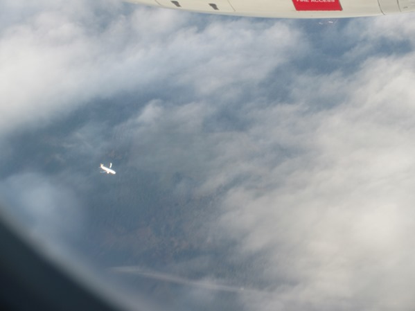
Near Berlin another plane passed deep underneath, heading for Schönefeld Airport. I wonder when then new airport will open, if it ever does, as this would making travel to my destination quicker as it lies at the southern edge of the city.
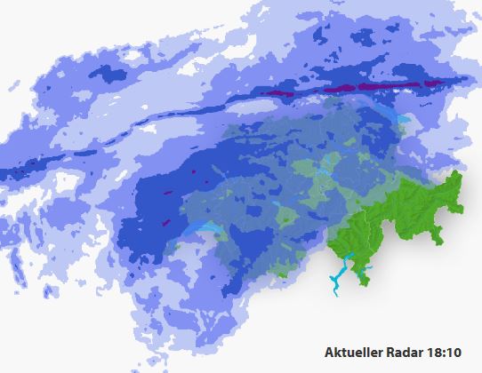
Waiting for my return flight I checked the weather in Zurich, as my wife told me on the phone that it is pretty stormy, and both METAR and TAF confirmed this.
METAR: LSZH 201820Z 23018G29KT 200V260 6000 RA FEW015 BKN025 BKN050 12/11 Q1000 WS ALL RWY TEMPO 4500 +RA BKN013
TAF: LSZH 201725Z 2018/2124 24020G35KT 7000 RA FEW015 SCT020 BKN040 TX07/2101Z TN01/2121Z TEMPO 2019/2021 4000 +RA BKN013 BECMG 2019/2022 34012KT BECMG 2023/2101 26010KT BECMG 2101/2104 NSW TEMPO 2110/2118 4000 SHRASN SCT040TCU PROB30 TEMPO 2112/2116 SHGS
Also the weather radar confirmed this, with a pretty strange thin line with heavy rainfall:
The approach to Zurich confirmed that also airline pilots are struggling with strong winds and turbulence, but the subsequent landing was survivable…
This weekend winter starts, with lot’s of rain and even snow down to the plains, so it’s time to start the replacement of all rubber hoses project. More on that later.