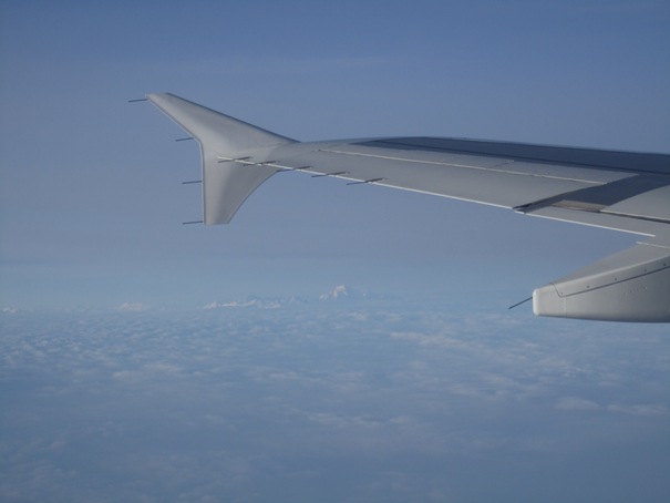
03.04.2013: Today I had to go to Brussels on business. After departure from Zurich we had a wonderful look at the alps, with the Mont Blanc visible just under the wingtip of the Swiss Airbus 320.
05.04.2013: I had to renew my medical today, which went as smoothly as I had expected. Still there is always a kind of tension, I guess that’s just normal with so much at stake.
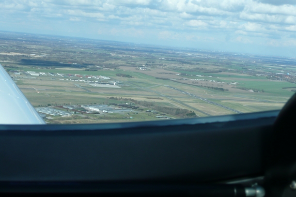
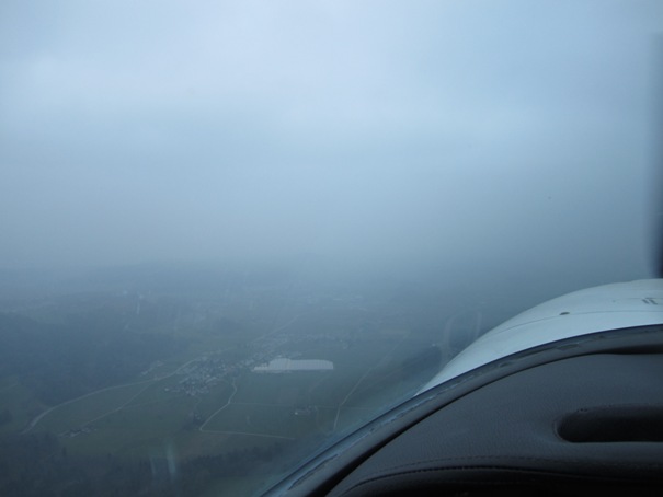
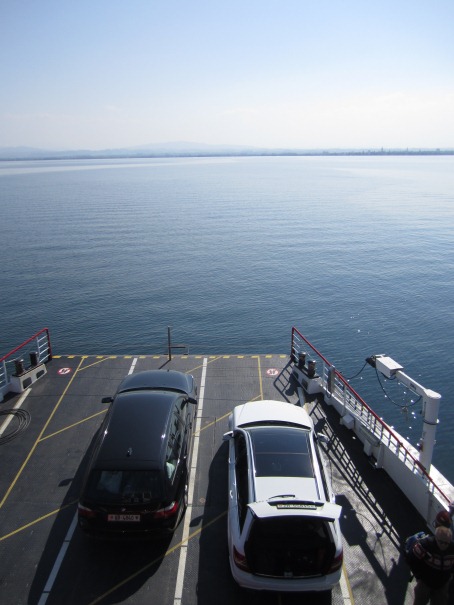
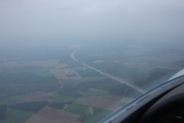
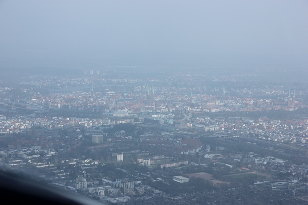
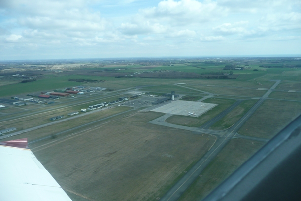
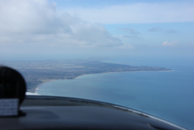
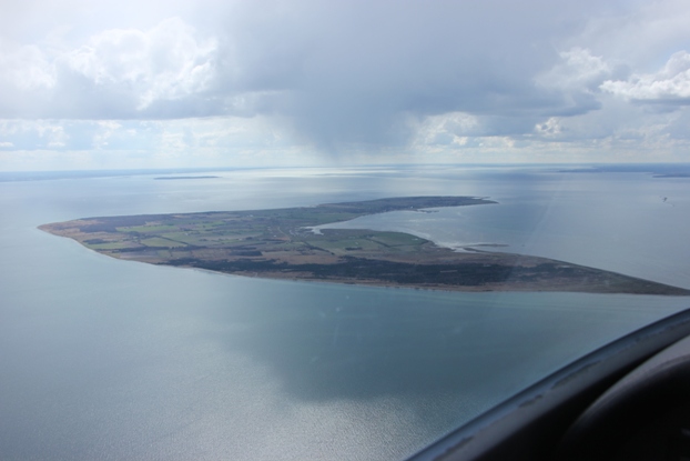
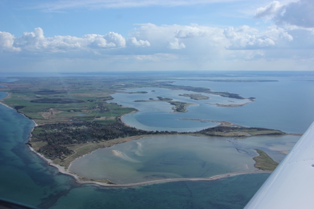
06.04.2013: Looking at the weather forecast for next week I just had to go flying today. Not that the weather was ideal for flying, but it will be worse next week. When at the airport I first hesitated whether it’s worth it, but then decided it would be the right day to do some low visibility training. The weather was something like that:
LSZH 061520Z 01007 KT 330V040 5000 HZ FEW 035 OVC 043 07/M01 Q1014 NOSIG
Which meant a ceiling of around 6000 ft with few clouds at around 5000 ft and a visibility of 5 km. One not often gets the chance to fly in such weather , which is legal but probably at the lower limit of the comfort zone for most pilots.
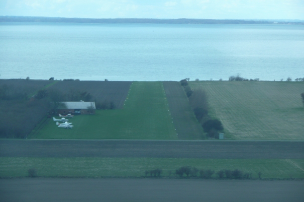
Here some photos, which show quite nicely what it felt like. First the view east, just before taking off.
I then flew east, doing some low level follow the highways and railway lines practice.
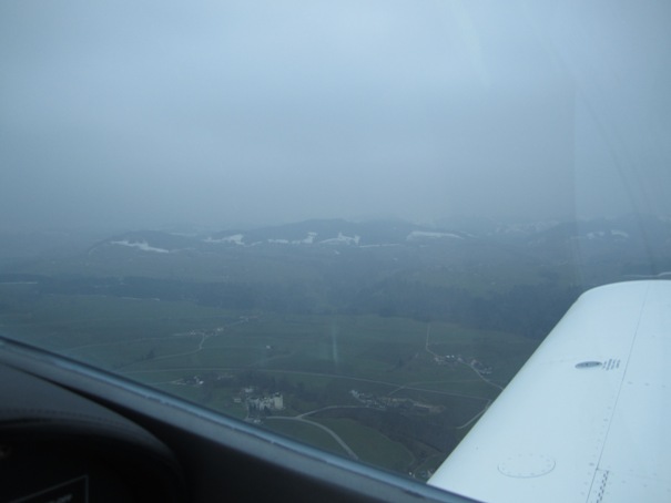
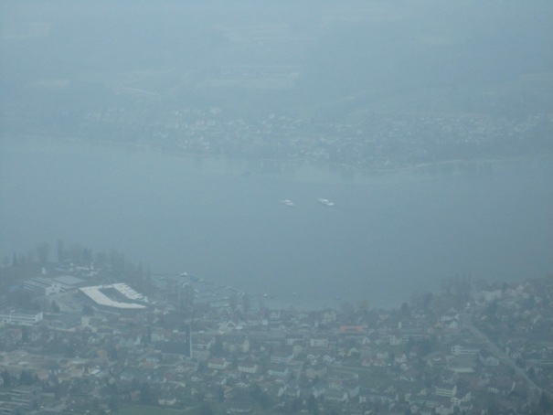
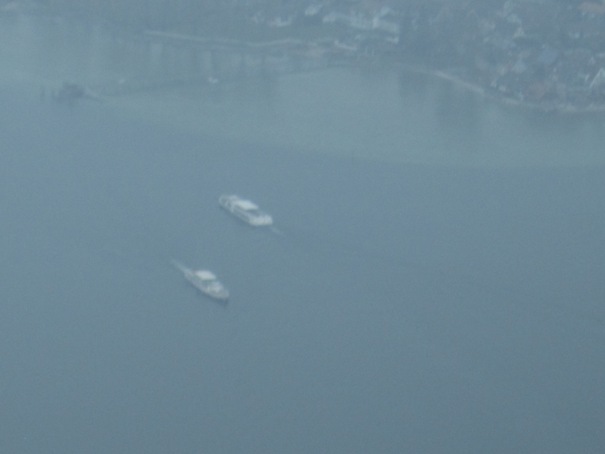
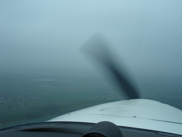
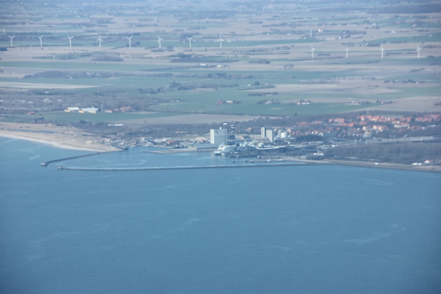
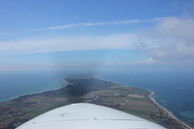
Then I turned towards the lake, where the visibility was a bit better,…
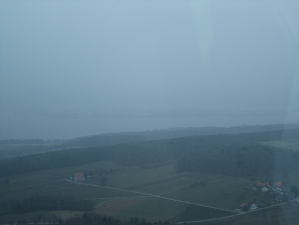
…with even some of the excursion boats already running. That reminded me that it’s soon Aero 13 in Friedrichshafen, where I usually go by boat.
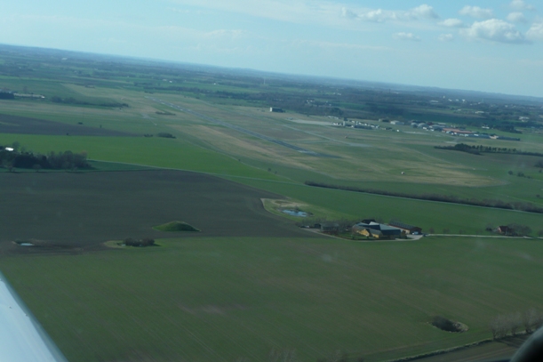
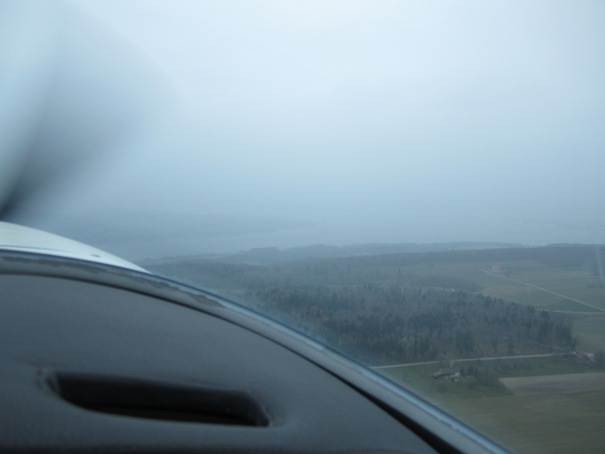
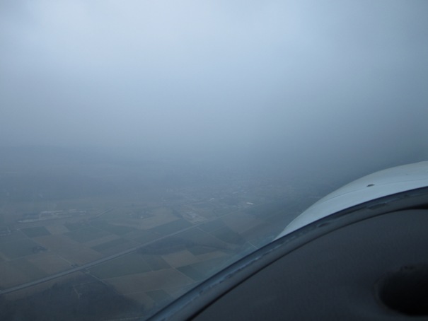
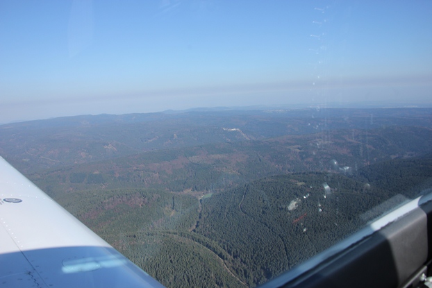
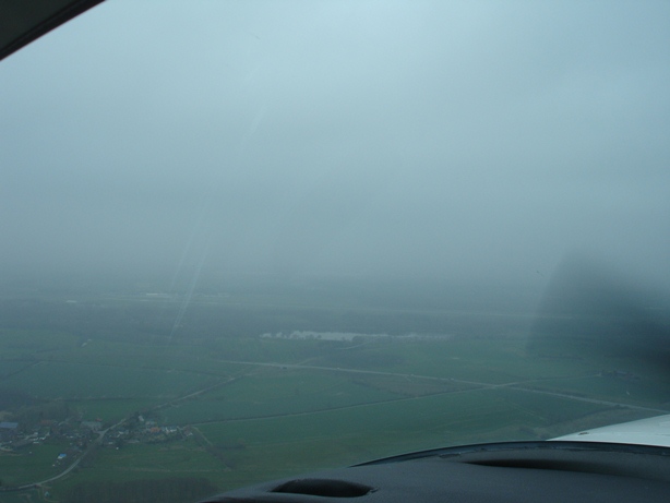
Flying back toward the airfield things got a bit worse again.
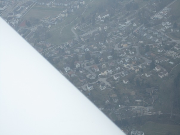
Below a view at my house, surprisingly with nobody sitting in the garden and waving to me.
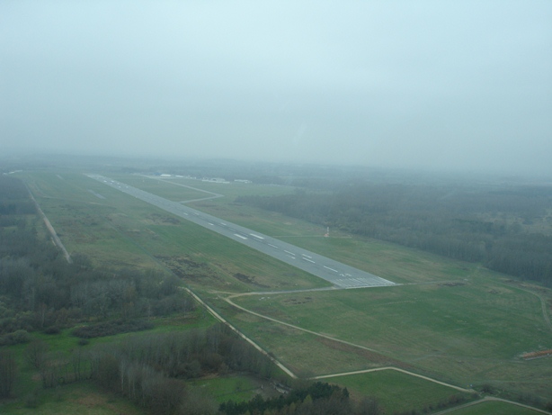
I believe it’s good to do such training once in a while, and it’s good to do it in an area well known such as around the home airfield.
12.04.2013: Today we had a meeting with the Federal Office of Civil Aviation to discuss some open issues with the Operations Manual of our sightseeing flight operation.
As we were already there we discussed some other issues, such as the language proficiency requirement. The result of the initial idea was to reduce misunderstanding on the radio by requiring a minimum level of proficiency with the English language, or whichever language used. The result is that many airports do not allow operations in English anymore, or only on certain days, such as on weekends, as their ground staff would also have to be trained, so national languages are used more prominently. To land at such airports one need a language proficiency check in the respective language, which foreigners often don’t have, which significantly limits access to airports to foreign pilots. In countries such as Germany and France stiff fines are given, and planes grounded, if one lands without the required proficiency entry in the pilot licence.
In Switzerland the situation in such that German, respectively French, is defined as only language on many smaller airfields, but English is used at most of them, so most operations are currently “illegal”. As far as I know there are currently not even processes in place to get a language proficiency check done in German of French, so there is something to clean up by the authorities.
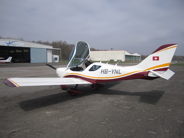
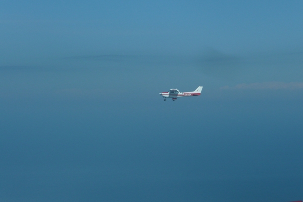
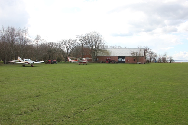
11.04.2013: Our mechanic asked today to to do a technical check-flight with the SportCruiser of our club, as he had to exchange the oil thermostat with a different type and wanted to see what the difference is in oil temperature control. The result is a much more stable oil temperature, and the engine also faster reaches the proper operating temperature, so I might consider changing mine too.
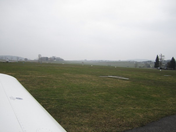
13.04.2013: I did my revalidation flight today, which went smoothly despite the quite turbulent weather. As I was already at the airport I also removed the cowling to check that everything is ok in the engine compartment. I am planning to fly to Denmark in two weeks, so this seemed a prudent step.
24.04.2013: It’s Aero time again, so of course I went there as every year. It’s only a short trip for me, so even though there are not every year spectacular new developments it’s still good to go there just to get the feel of it.
The weather was as perfect as it could be for flying, but as every year I went by train and ferry. I don’t need the hassle of slot management and high traffic density, and I am normally also quite tired after a few hours of visiting, so it’s easier to go back again via the leisurely way.
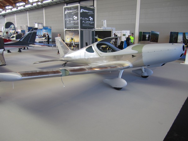
Some major things did stand out this year, however. One was a new low wing aircraft from Tecnam, called the Astore.
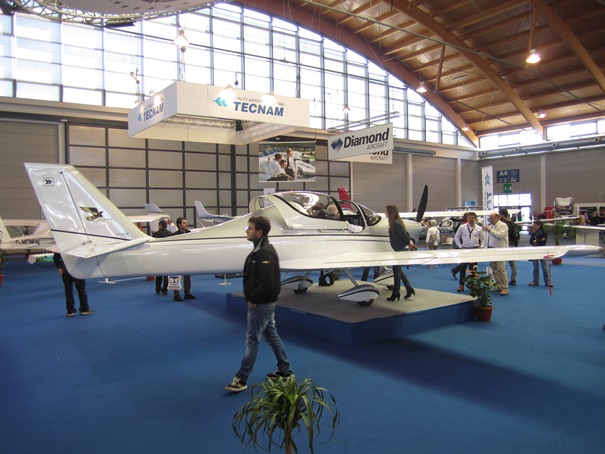
Even though it was only revealed at a ceremony at lunch time I managed to have a sit in it in the afternoon. I was interested in it as it is quite similar in layout to my SportCruiser, with the only major difference being a sliding canopy. I was however a bit disappointed once I sat in it, as it is not made for tall people like me. I am 187 cm tall, which I don’t consider exceptionally tall, and I hit the canopy when sitting upright even without a headset. That is the same with most Tecnam models. I don’t know why they just ignore taller customers. I also tried to sit in the high wing P2008, which is even worse, as I already had troubles entering it. Also, when the door is closed, I can’t see to the side except by taking an awkward, bent seating position.
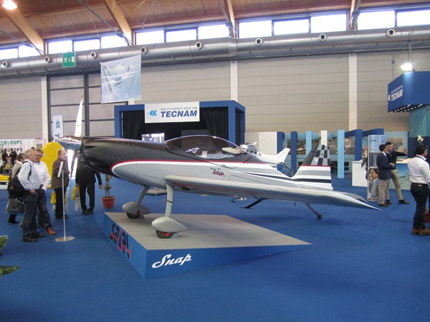
Tecnam also introduced an aerobatics-capable LSA, called the Snap, which is powered by a Rotax 912. It seems to be the first such plane on the market. Somehow odd is the technical data, which sais it is certified to +4/-2 g, but designed to +10/-8 g, I guess that is due to the certification rules, but I wonder whether there will be an issue with insurances if it is operated beyond the +4/-2 g envelope.
Another major thing was an iPad-based flight planning tool from Jeppesen, called “Mobile FliteDeck VFR”, which should be on the market in about a month. It seems to be a reaction to the success of the many low-cost flight planning tools available, such as PocketFMS, which I am using. Mobile FliteDeck is currently only available for the iPad, with neither an Android nor a PC version planned according to the Jeppesen guy I spoke to. They are also not supporting many standard functions, such as the export of routes to third party GPS’s, which in my opinion limits the usability of the software (at least for me). What impressed me is that the VFR charts as well as the VFR approach charts and airport charts are not separate charts, between which the tool is switching, but rather one integrated chart which just shows additional information the more you zoom in.
I was also a bit disappointed that neither Garmin nor Jeppesen would confirm that a VFR flight planning solution would be available that would put the approach chats onto the Garmin 695 I am using. One guy claimed that this is due to the limited memory available, but in the US an IFR solution is available that does the same. So, for the time I will stick to my paper VFR manual.
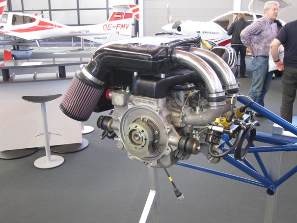
Another major new development is the Wankel type engine line from Austro Engine, the engine branch of Diamond Aircraft. They showed models of the engine with between 50 and 110 hp. All of them are very compact and very light. Below a picture of the 110 hp version, which weighs only 55 kg excluding radiator, silencer etc. The 80 hp version even only weighs 27 kg. And on top of that they are turbo charged, so no power loss with altitude. The only drawback is that they are consuming 2½ % oil per fuel volume, which is probably around 0.6 l per hour.
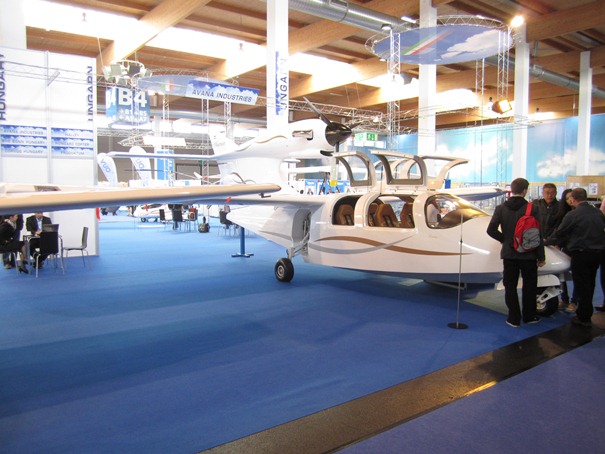
I also found a new project for me, a six-seat seaplane shown by a Slovak manufacturer. When I asked about certification however it became clear that they are only targeting amateur builders. It’s an impressive ship, powered by a Walter turbine, but I guess it will be one of these many projects that come and disappear.
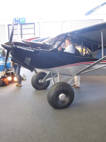
One thing I noticed at many booths is that big wheels seem to be the new trend. Below a picture of one of the many examples:
Finally electric power was again quite present, with some conversions of standard LSAs presented, but also some refreshingly new concepts such as the one below:
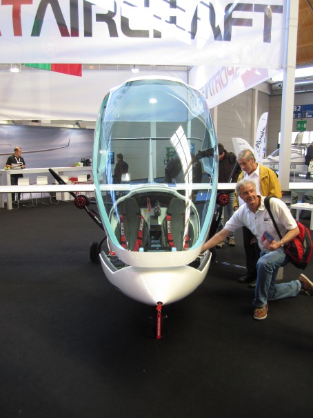
It’s a two seat, side by side motor glider type of plane, with two fold-out pusher propellers which are driven by small electric motors that are directly attached to the propeller. This eliminates the need for complex belt drives or similar arrangements.
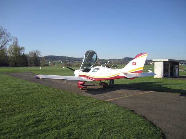
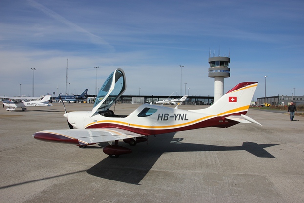
Of course Czech Sport Aircraft was present too. They had the new SportCruiser model on display in both analogue and glass cockpit version.
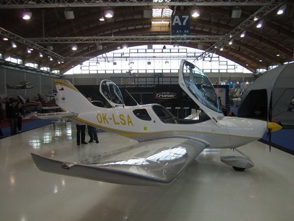
I showed the plane to some interested parties from Switzerland. They noticed themselves that there several significant differences between the SportCruiser and many competitors, such as the great view and that there is room even for taller pilots, plus baggage. It is also built in significant numbers (more than 500 flying) and supported by a professionally operating organisation. I know from my own experience, but also from our mechanics, that spare parts can be received in 48 hours. That’s a lot better than what we see from Piper, Cessna and the likes.
There were also quite a few SportCruiser derivatives around, here one with detachable wings and a tailwheel landing gear:
The day I see a conversion kit with amphibious floats that can be flown from a grass strip I will convert min SportCruiser accordingly.
25.04.2013: My wife is currently in Denmark, so I decided to go and visit her with my own plane. A friend from Denmark took the chance to come to Switzerland to attend Aero and then to fly back with me in my SportCruiser. He is not a pilot, but he often flies with a friend in Denmark and found it a cool ide to once do such a long flight. We thought that after visiting Aero we might have to wait for good for a few days, but today already looked ok so we decided to give it a try.
I had planned looked at several options for the flight, from flying nonstop to Roskilde to routes with one or two stops. I finally decided to stop twice, as this gives a little more comfort, and it’s also always nice to visit some new airports.
We got up quit early to prepare the plane, as I wanted to arrive in Denmark on the same day and to have some time margin in case we would have to get fuel or wait for customs or whatever.
We took off shortly after 8, with a flight plan and a report to Swiss customs already filed the evening before. This allows us to fly directly to Germany from Lommis without having to stop at a customs airport. I filed a flight plan to Aschaffenburg, EDFC, which is 1:40 from Lommis. That’s about a third of the way to Denmark. The time of arrival in Aschaffenburg must be announced to their customs two hours prior to arrival. Like that I could call them once we were ready, then climb in the plane and depart to arrive just about two hours later. In fact, we arrived only four minutes after the announced time.
After leaving Lommis I opened the flight plan with Zurich Information. We then proceeded more or less straight north, passing west of Stuttgart CTR. Below a nice view of the Lake of Constance, which marks the border between Switzerland and Germany.
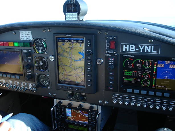
I had loaded the various routes to Denmark onto my GPS, so after selecting the proper one we could fly most of the leg on auto pilot. This is really helpful in such a light plane, as one can leave the controls to read maps, do paperwork or just to take pictures.
Zurich Information did not even assign us a squawk, as they were pretty busy with planes heading to Friedrichshafen for the Aero. They also seemed quite happy that we flew relatively low and stayed out of the way of all the other traffic.
Langen Information did give us their standard squawk for VFR, but was also very busy with Friedrichshafen bound traffic. They none the less gave us twice some traffic information.
Finding and landing in Aschaffenburg was easy. It’s a nice small airport with a very friendly and helpful person in the tower. Two guys from German customs were waiting for us, but again they were very friendly and polite. Turnaround was very fast, and the landing fee was only 10.04 €.
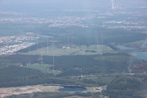
As the weather forecast predicted worsening conditions for the afternoon in the North of Germany we decided to continue straight, so we were airborne again after 35 minutes. Below a picture of a large antenna array which is located just north of Aschaffenburg airfield. One of the antennas is used to transmit the DCF77 time reference signal, which is used throughout Europe.
We then proceeded via Kassel, Göttingen and Peine towards Lübeck, EDHL, where the next stop was planned after a bit more than 2 hours of flight. We were back with Langen Information first and later handed over to Bremen Information. We did not even have to ask whether the various restricted areas were active, they always actively gave us the information when they noticed our route would bring us near to one.
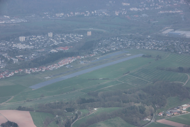
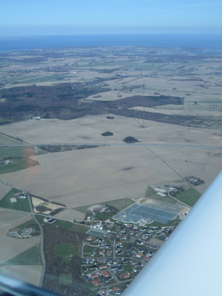
About 45 minutes after departure we passed an airfield where a large solar array has been installed parallel to the runway. It nearly looked like the runway, I hope nobody will ever mistakenly land on the solar array. I later found out that it’s Bad Hersfeld airfield, and that the runway is 615 m long, so the solar array must be around 750 m long.
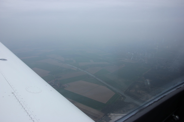
The weather was not as bad as predicted, but the cloud base dropped lower and lower. We were initially flying at 3’500 ft, but later descended to 2’500 ft and for some stretches even to below 2’000 ft.
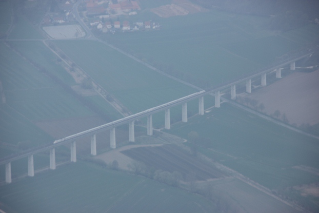
One visual reference to follow was the high speed railway line from Kassel to Hanover, with its many bridges and tunnels.
South of Peine we crossed the Mittelland-Kanal, the longest canal in Germany that runs East-West for more than 300 km connecting Rhine and Oder.
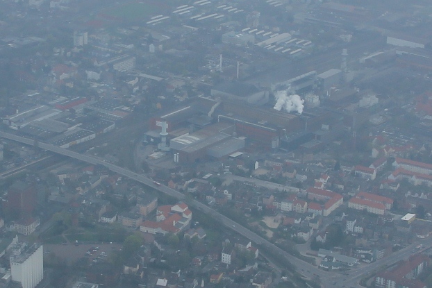
In Peine we could clearly see the large steel mill right in the centre of the town. Even though I fly largely on GPS, using VOR’s as backup, I still plan routes with good visual references that I can follow on the map. This would help me in case of a failure of my navigation equipment, even though this is extremely unlikely as I have two GPSs, one of which is backed up by an internal battery.
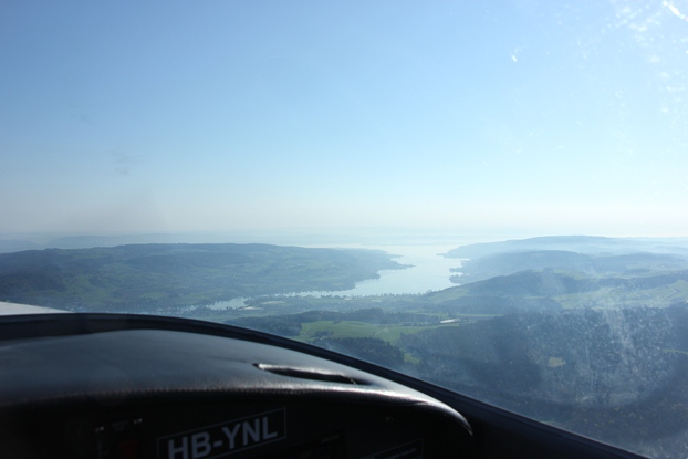
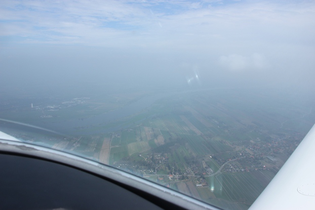
A bit later we crossed the Elbe river near Lauenburg, something one can’t miss even in poor visibility. The visibility improved from there, we even saw blue sky.
From there we could follow the Elbe – Lübeck canal, which lead us to the southern reporting point of Lübeck-Blankensee airport.
Shortly before Lübeck the visibility worsened again, so for landing we got a special VFR clearance. This was however no problem, as the approach is along a narrow lake, with the last reporting point at the end of the lake, and from there we could already see the runway. The sequence below shows the approach from the lake to the runway.
To our surprise the tower announced after the landing that the fuel station was out of service. We met two friendly guys from the local flying club, which were waiting for the weather to clear, and discussed with them where we could stop instead for fuel. I still had fuel for about two hours, but the flight to Roskilde was planned to take 1:30, which I considered not safe due to the weather conditions. The guys recommended Kiel, which would also have customs possibilities, but then the news came that the fuel station was working again. We therefore quickly refuelled with AVGAS, as no MOGAS was available, and then headed off for Roskilde after about 1:20 on the ground.
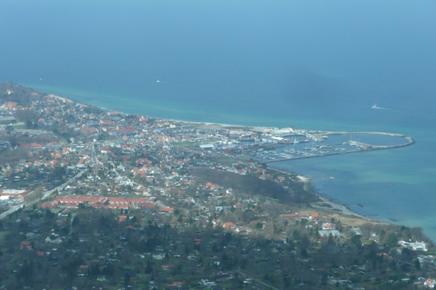
As can be seen in the picture above the weather had improved quickly while we were on the ground, so we left in much better conditions than when we arrived. We departed to the west and then turned north towards Fehmarn. Below Lübeck to our right…
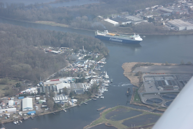
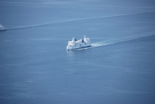
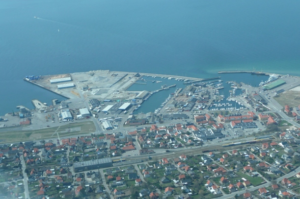
…and Lübeck Travemünde harbour, where many ferries leave for Norway, Sweden and Finland.
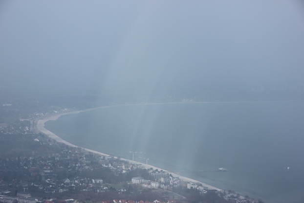
We then followed the endless sand beaches on the Baltic sea.
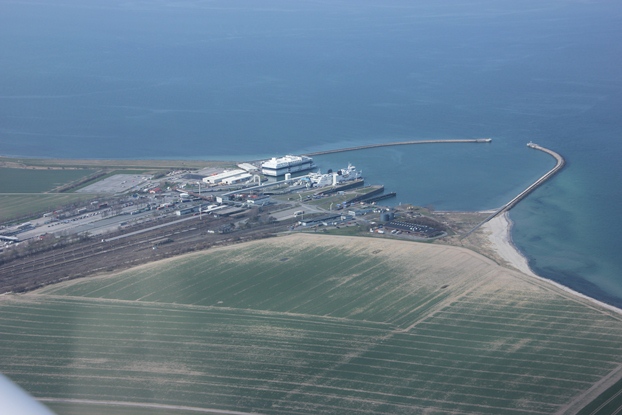
We also passed the famous bridge to the island of Fehmarn that carries both the railway line and the road to Puttgarden, the ferry terminal to Denmark. Both the ferry terminal and the bridge were built in 1963, significantly shortening travelling times to Denmark.
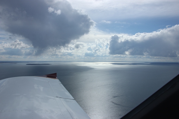
Below the ferry terminal at Puttgarden, the beginning of our crossing of the Fehmarn Sund. The distance between Puttgarden and Rødby on the Danish side is around 20 km, which would require around 3000 ft of altitude to reach the shore in case the engine would fail right in the middle of the crossing. We flew a bit lower, due to a layer of mist above 2500 ft, so I did not tell the engine that we were flying over water.
In case of trouble we would have had life vests on board, and there is also always a ferry nearby.
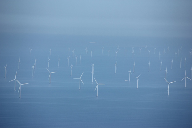
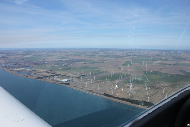
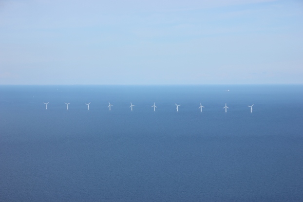
East of the crossing are two large offshore wind farms, which together consist of around 150 wind mills. That’s quite an impressive sight from the air.
The crossing only took around 6 minutes, below the ferry terminal of Rødbyhavn on the Danish side. While crossing the Sund we were also handed over to Copenhagen Information.
Just east of Rødbyhavn there is also a large on-shore windmill farm, producing wind power seems to be one of the main businesses in this part of Denmark.
Just behind the wind farm lies Lolland-Falster airport, which does have some customs services but only on a few days per week and during office hours. We therefore continued directly to Roskilde, which provides all services throughout the day.
We followed the main motorway toward Copenhagen, which crossed below one of the many Sunds they have in Denmark. Some of them are used for serious shipping, so bridges would have to have significant clearance. The tunnel looked however quite odd, as if the bridge was missing.
The reporting point to enter Roskilde CTR is located conveniently where the motorway reaches the shore near Køge, so again easy to find. The weather had improved so much that all Danish hobby pilots seemed to have gone flying, at least it sounded like that on the frequency of Roskilde tower.
The landing was however uneventful, apart from the plane behind us having to do a go around as we were too slow. The ground staff was extremely friendly, so we could just park our plane, tie it down and leave. They even wanted to organise ground transport, but my wife already waited to pick us up. Below a picture she took from inside the terminal just after we had arrived.
I of course also took a picture of the plane in front of Roskilde tower. The airport is quite large in the sense that they have two crossing runways, each of which is 1800 m long, but it does not handle any scheduled flights. Instead most business jets bound for Copenhagen land in Roskilde, and there are also some military helicopters based there.
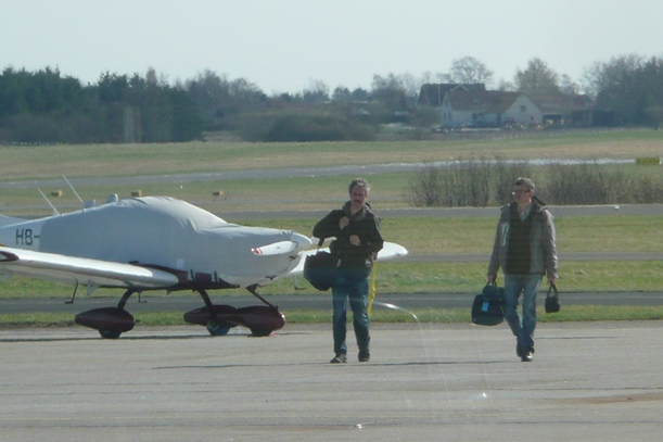
Once we had securely tied down the plane we brought our luggage to the car and left. It’s nice to park the plane in a secured area if you leave it for a few days.
27.04.2013: Nice weather was announced for today and it was on my agenda to fly to some of the small islands here in Denmark, so we decided to give it a try. My friend Joern, who flew with me from Switzerland to Denmark, asked one of his friends who owns a share in a Cessna 172 to join us, so that I could fly with my wife in my SportCruiser. The Cessna is not stationed in Roskilde, but at a small farm strip north of Copenhagen. They needed fuel, however, so we agreed to meet in Roskilde and fly from there together first to Samsø, and then to Endelave.
In Roskilde I asked whether I should pay my fist landing fee and two days of parking before leaving, but when I told them I would be back in the evening and stay for another few days they told me I could as well pay everything when I left for Switzerland.
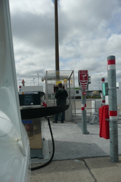
I also refuelled, again with Avgas as Mogas seems pretty rare in Denmark. They have gas stations from both BP and Shell, but only Shell takes credit cards so the choice was easy.
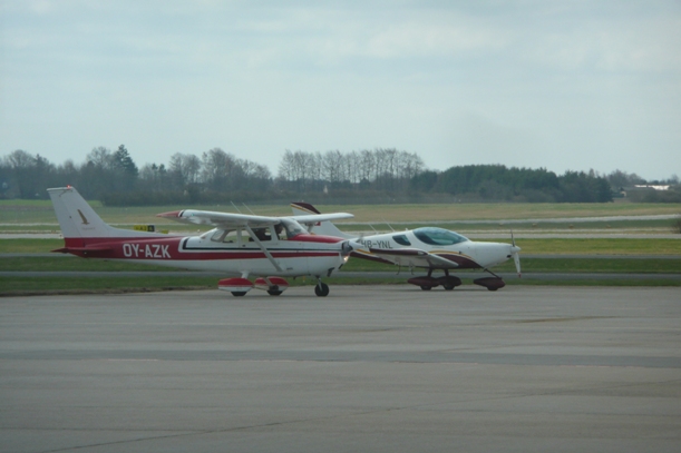
Once the guys in the Cessna had arrived and refuelled too…
we left Roskilde to the North flying all the way up to to the northern coast of Sjaelland.
From there we followed the coastline east, past Hundested…
…where we visited a museum yesterday (the grey roofed house in the middle), the former home of the famous Greenland explorer Knud Rasmussen (ok, maybe not everybody knows him).
When then continued along the coast…
…and then out to the Sjaellands Odde, as small peninsula that sticks out into the Kattegat.
Copenhagen information noticed that we were flying together, so they proposed to help us if one lost sight of the other one. This was however not necessary, as the weather was very nice with excellent visibility.
From Sjaellands Odde it is only a short hop of 25 miles across the Kattegat to Samsø. Flying over water for such a distance finally justified my investment into two life vests.
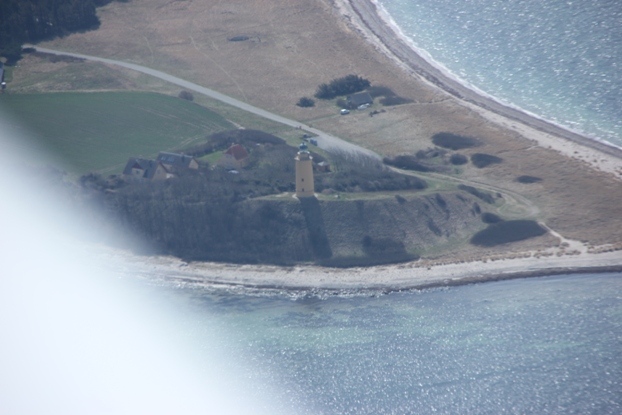
On the way to Samsø we passed another small island, called Sejerø, but we could not land there as it does not have an airport. It does however have a nice lighthouse at its northern most tip. We also passed other small island, some of them seemed not inhabited.
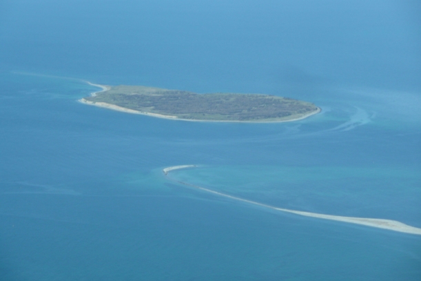
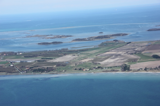
Finding Samsø airfield is easy, as it lies in the middle of the bone shaped island and next to a kind of lagoon.
Due to the westerly wind we had to land form the lagoon side, which is very nice as one has the feeling to land on an island in the Caribbean sea. Here a view of the lagoon, which is filled with crystal- clear water.
Below a view of Samsø airfield when approaching from the lagoon side.
After getting out of the plane the lagoon feeling quickly disappeared, as it was pretty windy and cold, probably below 10 degrees.
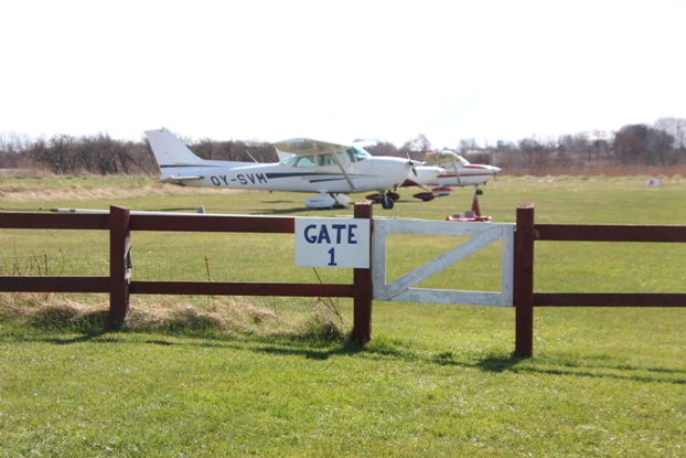
Samsø airfield is privately operated by a guy with some sense of humour. There are two terminals…
…and two gates, from where planes depart.
I took the chance of a small airfield to give Jens, the other pilot, a short ride in the SportCruiser. He has never flown in anything but Cessnas, so a light and sensitive low wing airplane was quite an experience for him.
After our little excursion we paid the landing fees…
…and then continued to Endelave. Below a view back to Samsø airfield shortly after takeoff.
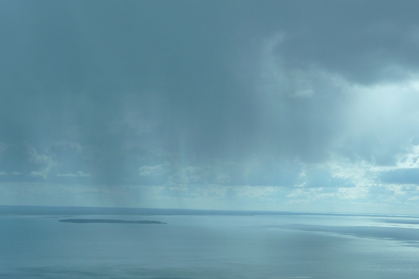
On our short way to Endelave we passed some shower areas, but that’s as close we got to rain for the whole day.
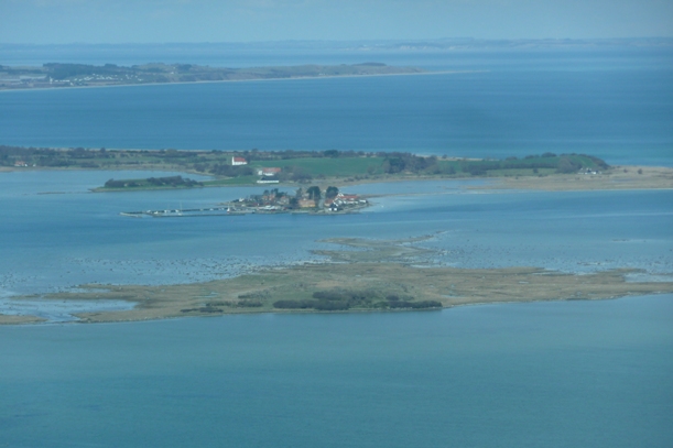
Endelave is only about 20 min from Samsø, and again easy to find. The airfield is again privately operated, and sits at the rear end of the island.
Here a view on short final, the runway is 615 m long, longer than what it looks like.
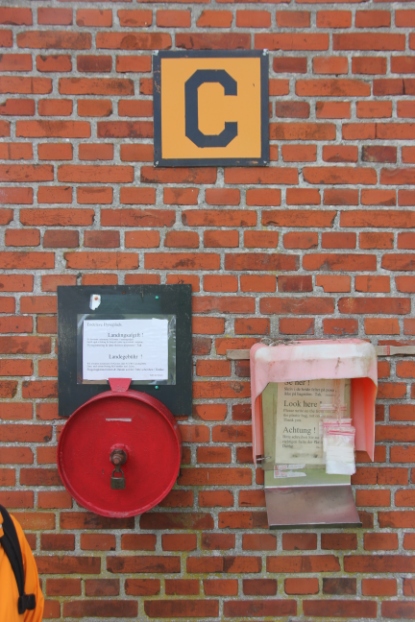
The owner of the airfield is 86 years old and came to greet us. He was very interested in my plane and asked many questions. It’s possible to put up the tent on the airfield, something I hope to be able to do sometime on an extended tour to the many Danish islands.
The “C” office consists of a box bolted to the wall where one can deposit the small landing fee.
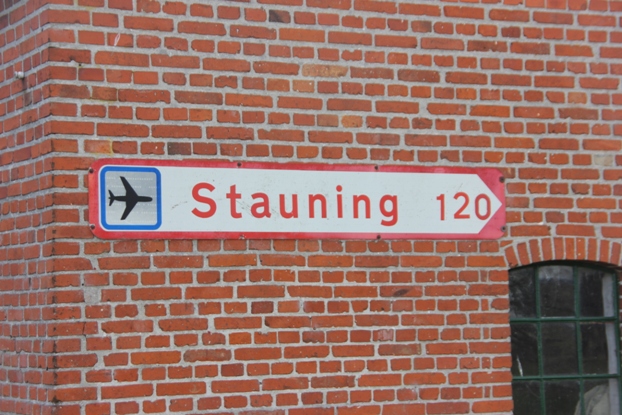
The sons of the owner were there too, one of them lives in Stauning and typically comes visiting by plane. That’s maybe 45 minutes to fly, but three hours by car as one has to take a ferry too.
Unfortunately we had to leave again, Jens flew back to his farm strip and I flew back to Roskilde.
On our way back we flew along the east coast of Fünen….,
…passing Kerteminde where we spent some very nice summer holidays with the kids many years ago.

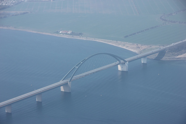
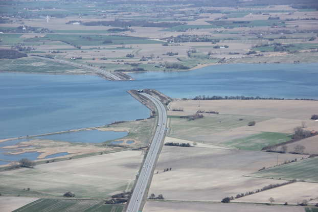
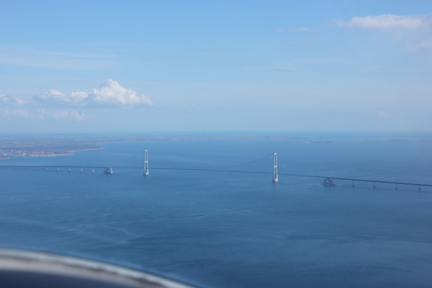
From there we also passed the bridge across the Størebelt, which is 18 km long, consisting of two 6.5 km long concrete bridges connected by a suspension bridge with 1.6 km span. It’s the longest suspension bridge in Europe and the third longest in the world. The two towers are 254 m high, around 70 m higher than the highest mountain in Denmark.
From the bridge it took another 20 minutes back to Roskilde, where we parked our plane again.