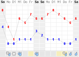
16.01.2022: Another year starts, and probably another one where COVID dominates our lives. Regarding flying I have managed to do around 25 hours last year, about the same as in 2020, but more than in 2019. Let’s see what the new year brings.
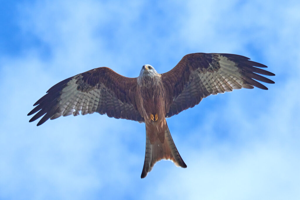
I was pretty cold and windy today, and also foggy until early in the afternoon. So instead of trying to go flying I tried to take some nice pictures of the Red Kites which were circling pretty low above our house. I love to watch them, we see them every day as we live close to the edge of a forest.
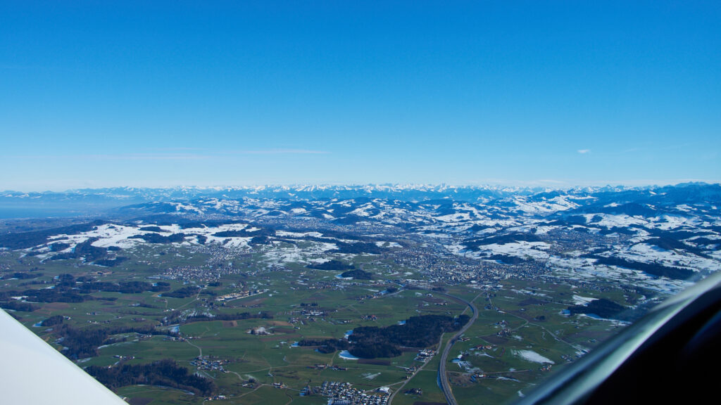
22.01.2022: I unexpectedly got a “day off” on Saturday, as a private visit was cancelled due to COVID, so despite the fairly poor weather forecast I drove to the airfield to go flying. The forecast spoke of low clouds, overcast and fog in the eastern part of the country (where I live), as well as of moderate icing from 4’000 ft to FL100. So when I took off I headed in a southwesterly direction, where the sky looked brighter than towards southeast, where the mountains were indeed hidden in a low layer of clouds.
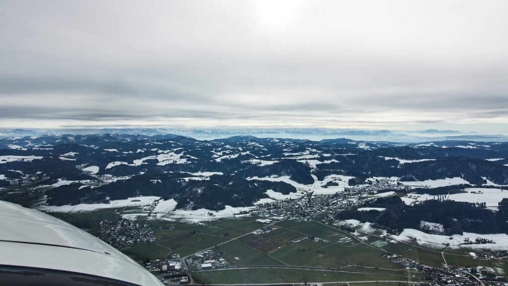
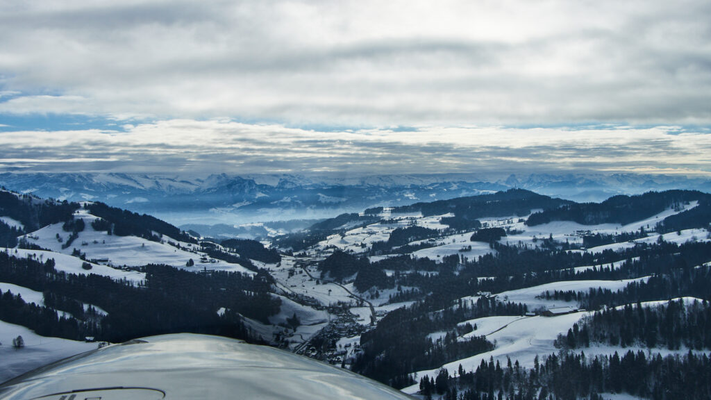
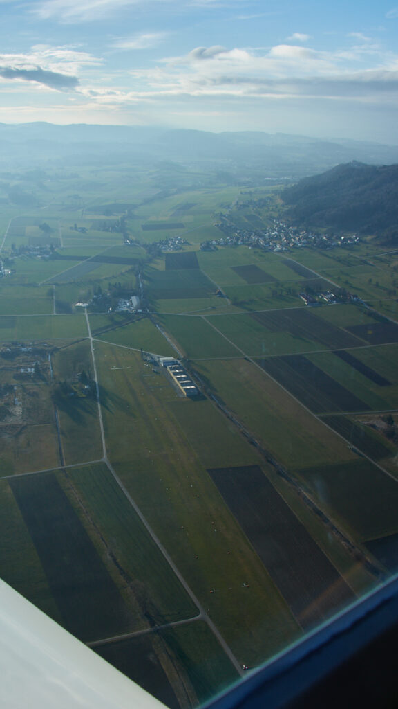
I stayed low, due to the icing warning, passing the Hörnly (3’717 ft) below 4’000 ft. I nice weather it can be quite crowded, but there was absolutely nobody. That the eastern part of the mountains was covered in clouds can be seen in the background.
The weather looked better ahead, with some bits of blue sky becoming visible.
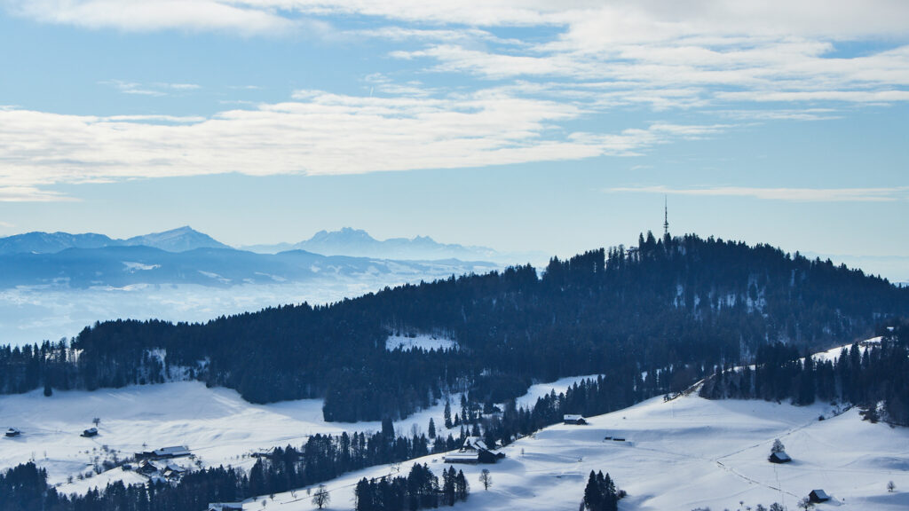
When I passed the Bachtel (3’658 ft), the blue patches became bigger, with the Pilatus (6’981 ft) in centre of the picture in full sunlight.
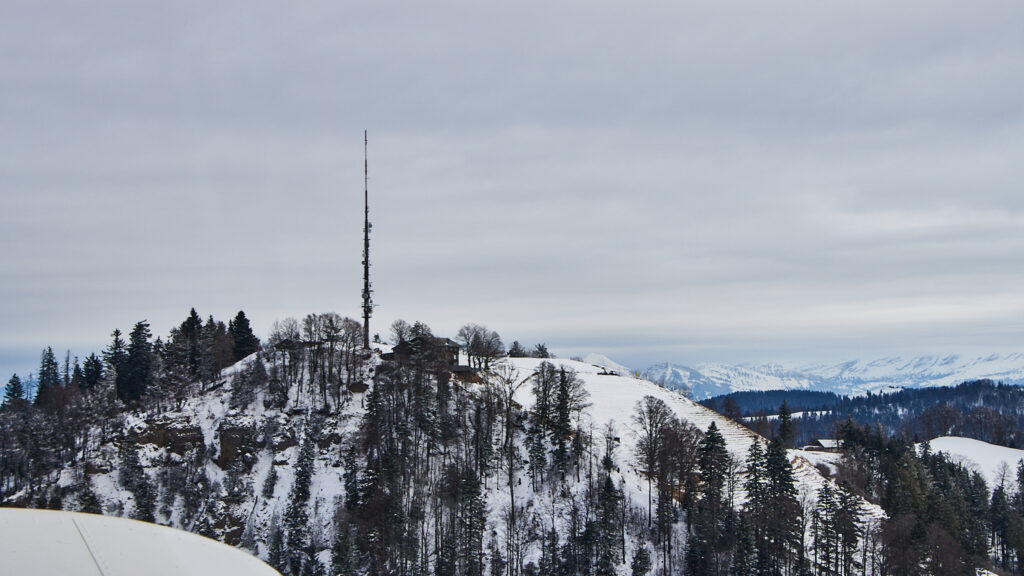
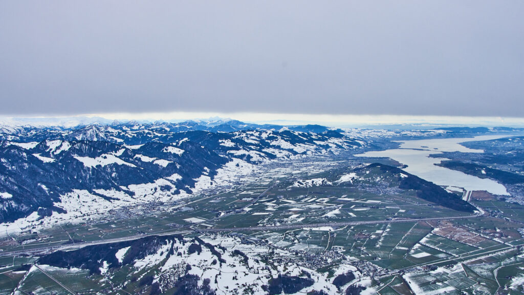
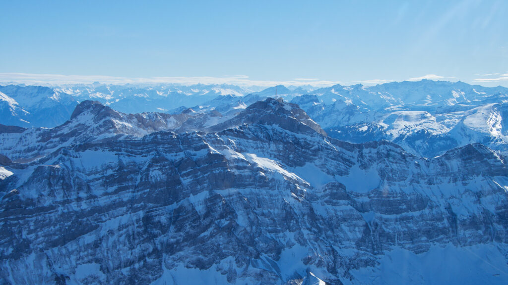
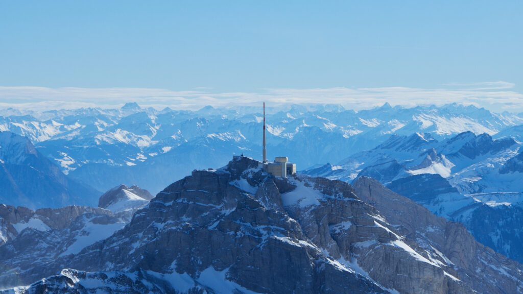
I continued across Lake of Zurich, heading towards the Rigi (5’897 ft), which I circled at around 6’500 ft, the highest point during my flight.
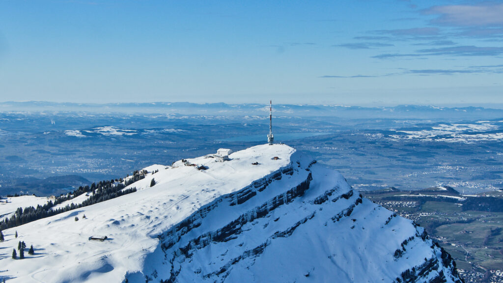
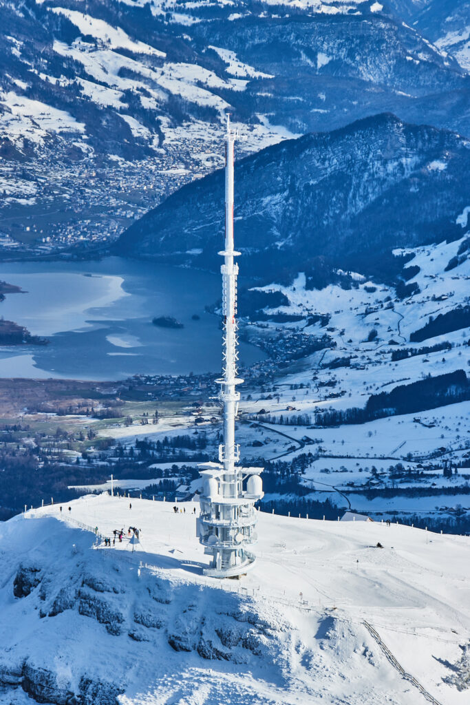
The radio antenna on top looked nice, as it was covered by a thin layer of ice. One can see a few tourists enjoying the spectacular views.
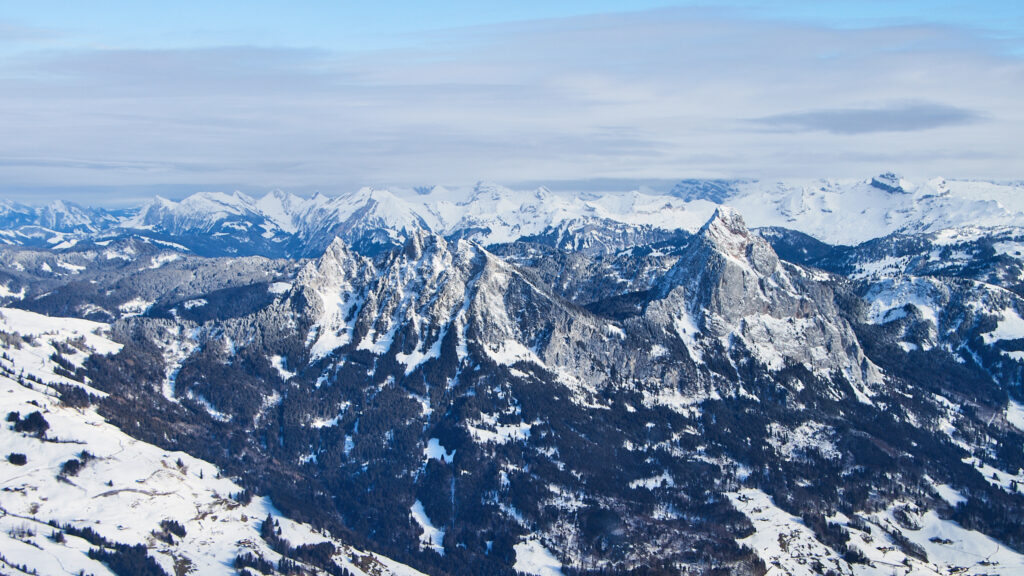
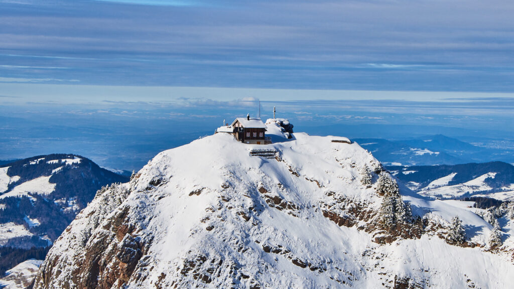
I then turned east again, passing the Mythen mountains, with the little restaurant on the taller one. Despite the impressive look of the mountain one can walk up there in summer on an easy mountain path, but everything looked closed now as the path is covered by snow.
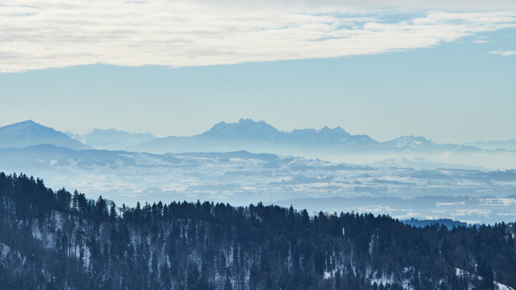
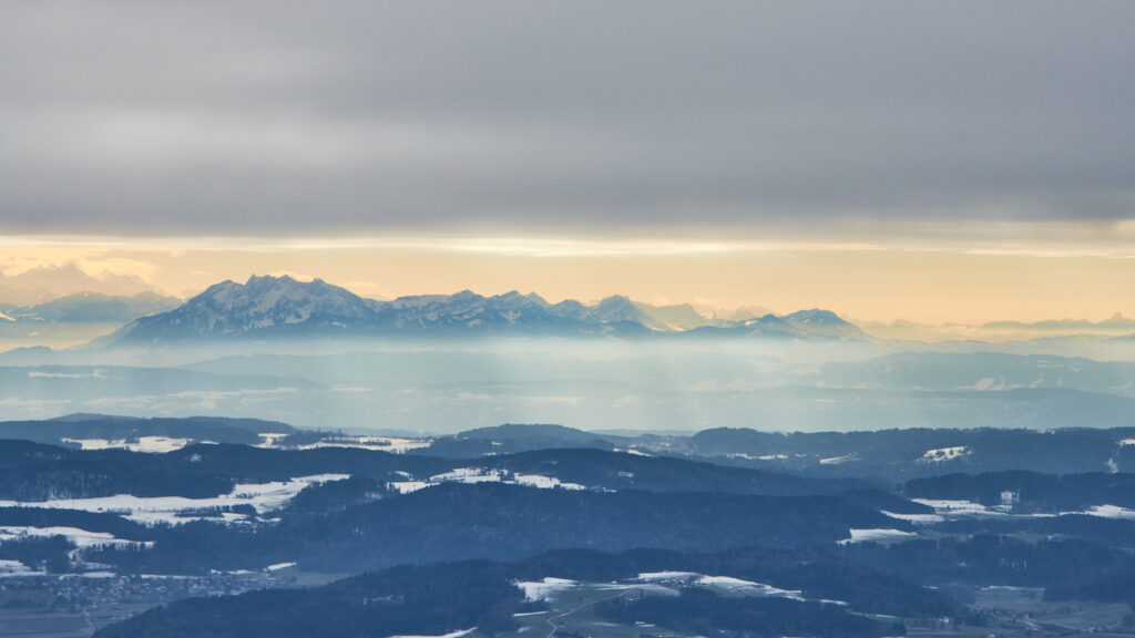
Returning east I initially maintained 6’500 ft, but the cloud layer got lower and lower, as can be seen below when looking back towards Pilatus.
Below a last view back towards the Pilatus from somewhere north of Lommis, a distance of around 90 km, with the sky starting to show some nice colour. What was initially planned as a short local flight turned in to a really nice one and a half our tour of the mountains. Once more it was confirmed that one should never cancel a planned flight just because of the weather forecast, before having had a look at the true weather yourself.
29.01.2022: When looking at the weather forecast for the next 15 days this morning I realised that I absolutely have to go flying in the afternoon. We will get quite some rain and snow during next week, which not only prehibits flying, but which will probalby result in a closure of the airfield for some time as our grass the runway is already quite soft. We are already at the point where only home based aircraft are permitted to use the airfield, and not for circuits, so any additional rain will likely result in a closure.
For today however, the weather forecast looked promising, with blue skies and temperatures up to 8 degrees above freezing predicted. They however also predicted moderate turbulences from 2’000 ft to FL080 and 30+ kts wind at 10’000 ft, so I decided to do one of my “high altitude” flights over the alps.
Below a view towards the alps, from shortly after departing Lommis. One can already see that there is not much snow.
When approaching the Säntis there were already 35 to 40 kts of wind from a norh-westerly direction, so I decided to climb to FL115, and stay a safe distance from an moutains. At that flight level there were no turbulances at all, so I had a smooth ride during the entire flight.
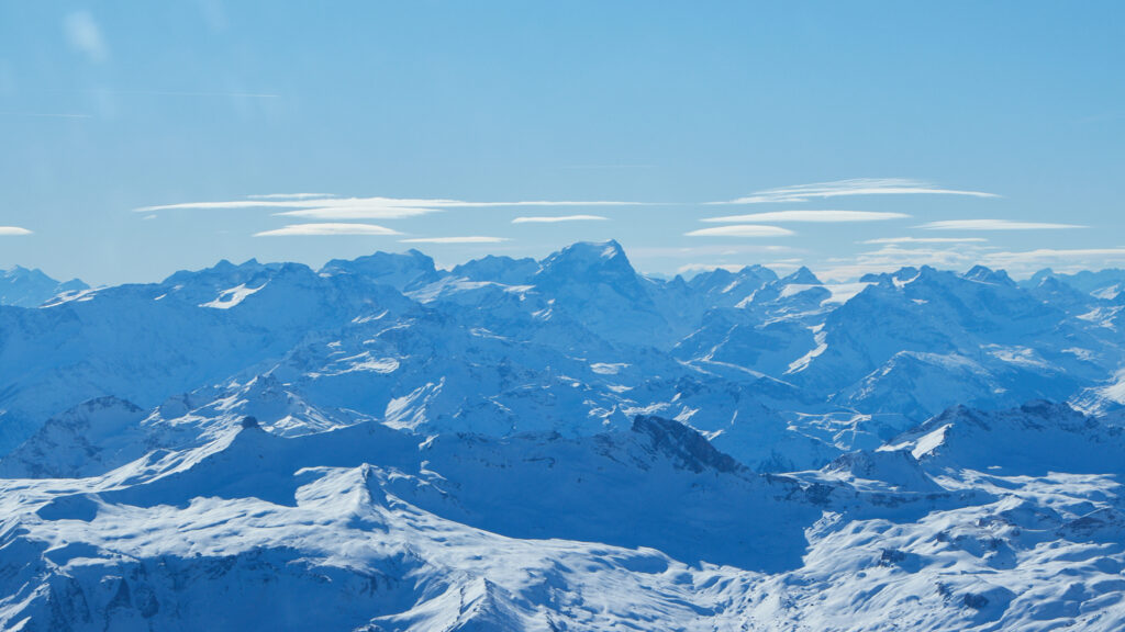
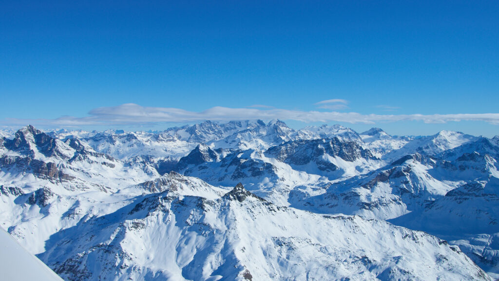
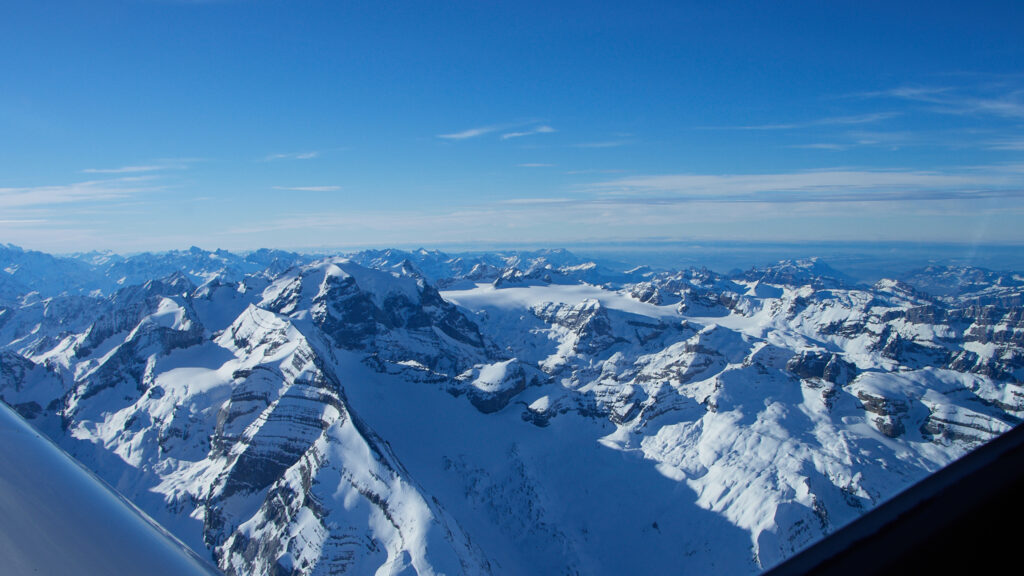
Below is a nice view of he alps, with a bunch of Lenticularis clouds. These are a typical sign of strong winds across the Alps, either from south or from the north.
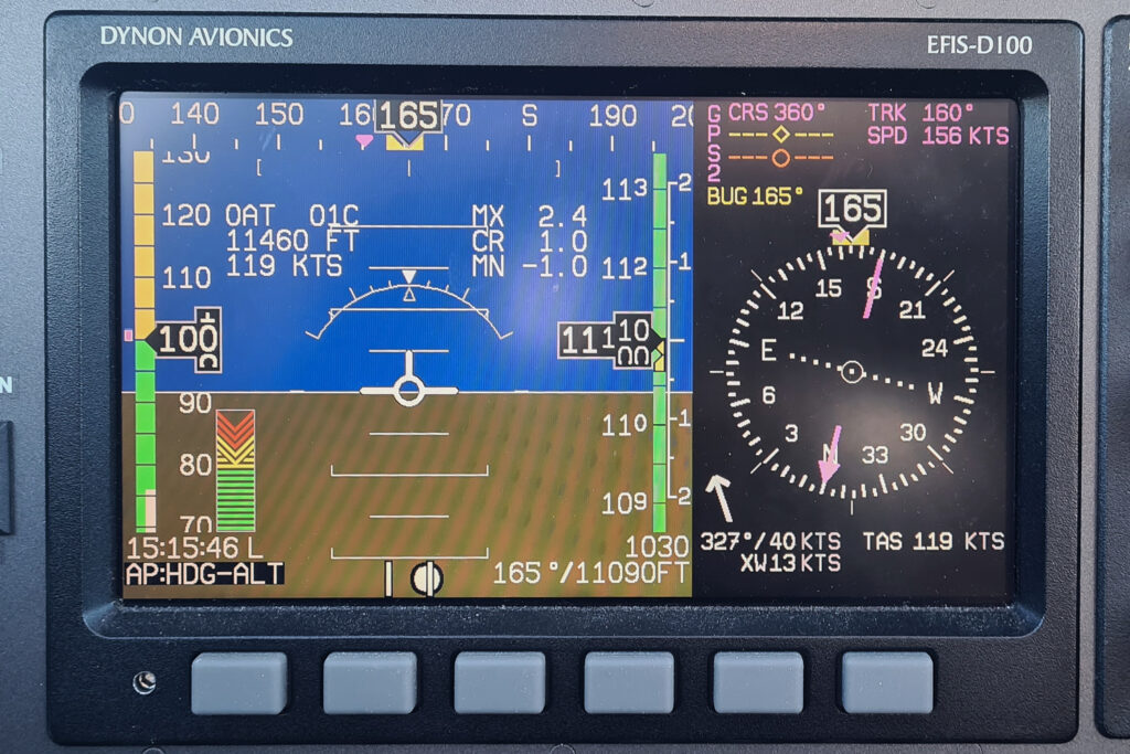
I decided to head toward the Engadin valley, to check how much snow there is, which means flying in a south-easterly direction. That meant I had the wind more or less straight from the tail, resulting in what is probably my highest ground speed so far.
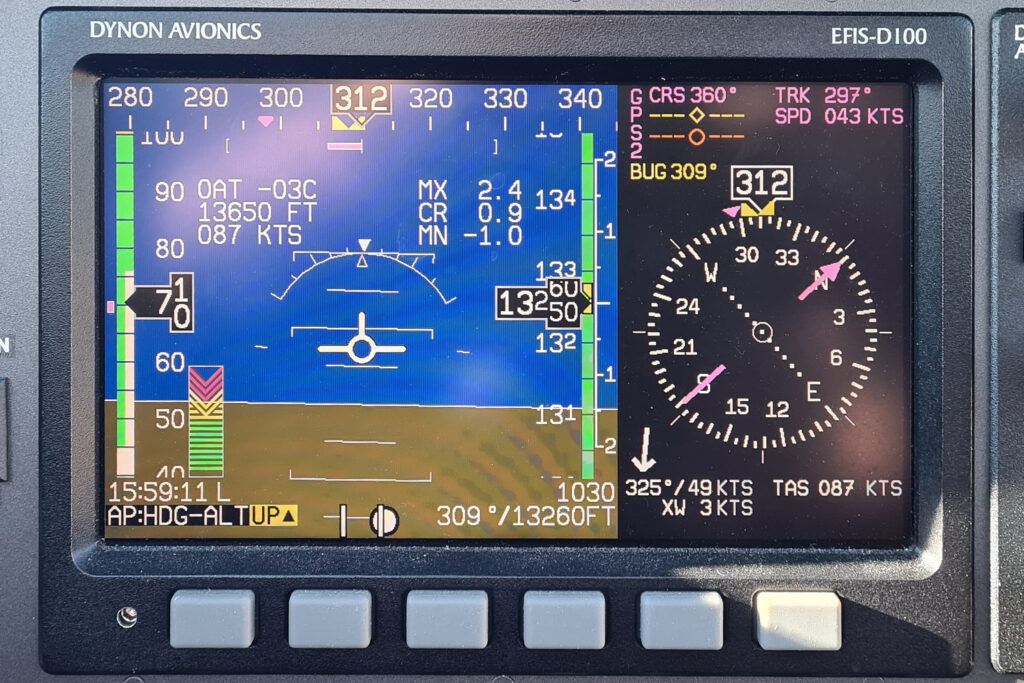
The Garmin GPS showed 156 kts of ground speed, with 100 kts indicated speed at 11’110 ft (11’460 ft density altitude) and 1oC OAT, which results in a true airspeed of around 119 kts. That means there was a tail wind of 37 kts, which nicely matches the 40 kts indicated by the Dynon, coming from the rear with a slight angle. If checket this many times, the indicated wind on the Dynon is indeed quite accurate. It is a really helpful feature. also to e.g. check for crosswind when landing.
I climbed to FL125 when approaching the Engadin valley. I wanted more clearance from potential turbulance caused by the mountains, but also not to interfere with the many jets flying into and out of Samedan as it is peak season there.
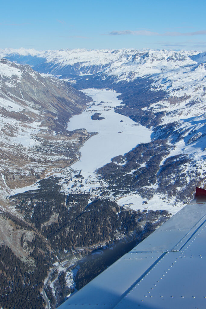
Below a view from above Maloja towards St. Moritz. One can see how little snow there is.
I then turned around, flying north again, which meant that the nice tailwind now turned into a headwind.
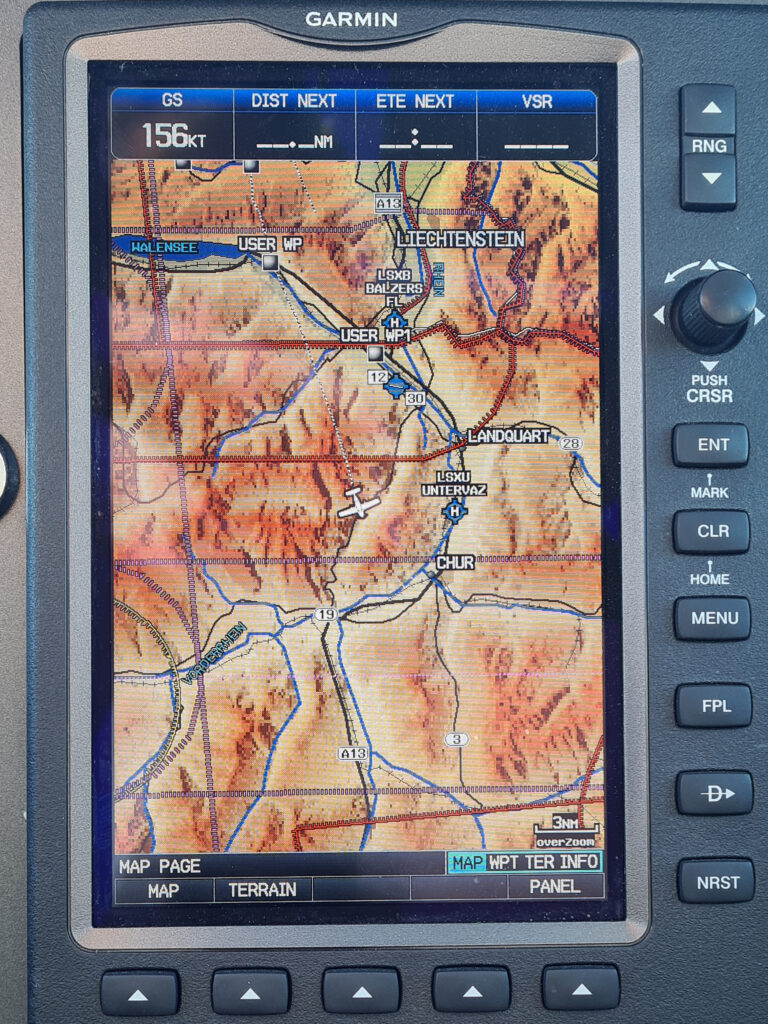
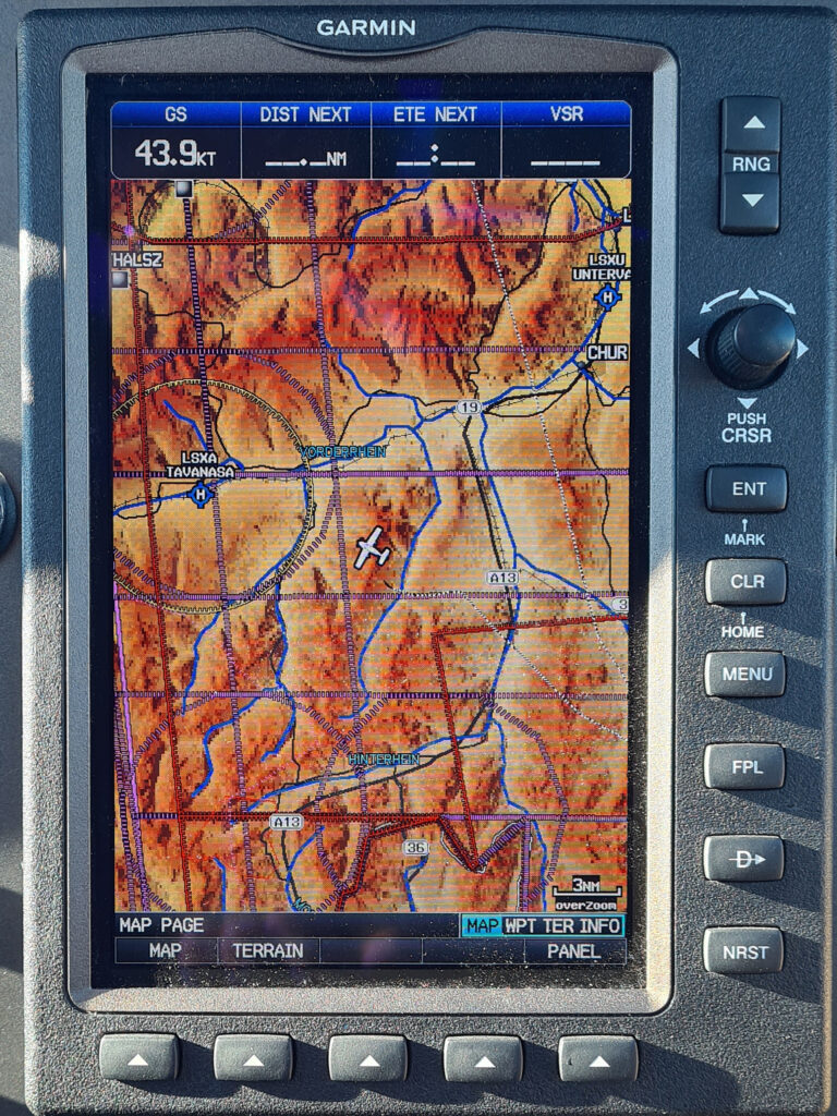
That resulted in some spectacularly low ground speeds, the lowest value I saw was around 44 kts. I was still flying at FL125, which meant 13’250 ft, but I was crossing a rim (as can be seen on the map of the GPS below), which goes up to around 9’000 ft. Even though that gave me more than 4’000 ft of clearance from the terrain, there was still quite some downdraft on the lee side of the rim, which meant the autopilot commanded a climb to maintain the selected flight level. As a resulted the indicated speed dropped to 70kts, which, at that altitude and temperature, meant 87 kts true airspeed. That true airspeed minus the 49 kts of headwind that resulted in the very low ground speed. But despite all of that, the ride was extremely smooth, with no noticeable turbulences whatsoever.
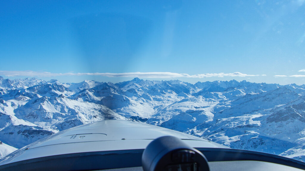
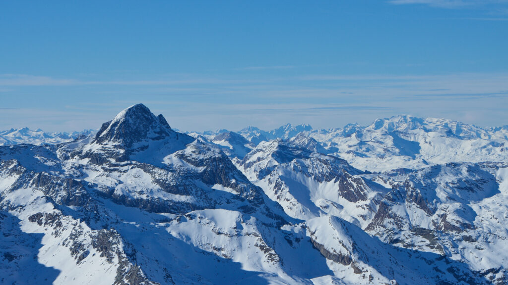
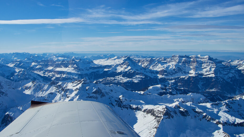
I then headed over the Kisten pass near the Tödi (11’425 ft), which is shown below.
From there I headed back towards Lommis, in a shallow descent.
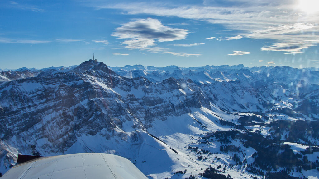
I passed the Säntis again, one can already see the change of colours as it was already close to 16:00 local time (sunset was at 17:21).
When I started the descent from FL100 near the Säntis towards Lommis I noticed that the weather forecast was pretty accurate. From around FL080 there was quite some turbulence down to the circuit height in Lommis at 2’400 ft.
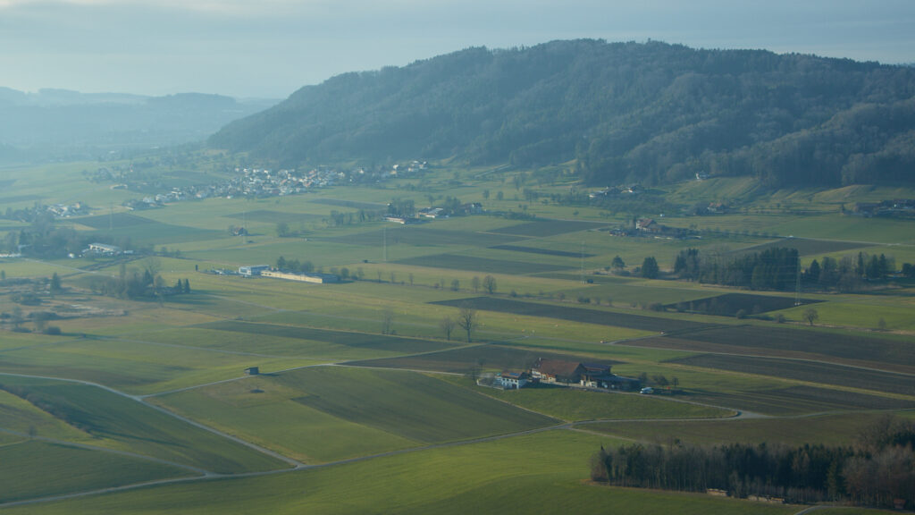
Below two pictures of Lommis airfield, the first one taken when entering the overhead circle at around 3’000 ft (Lommis is at 1’539 ft), the second one from when turnign to the base of Runway 24.
Again an extremely nice flight, which lasted a bit more than two hours. What stunned me the most was that I saw no a single person at the airport from when I arrived shortly after 13:00 until when I left at 16:30.
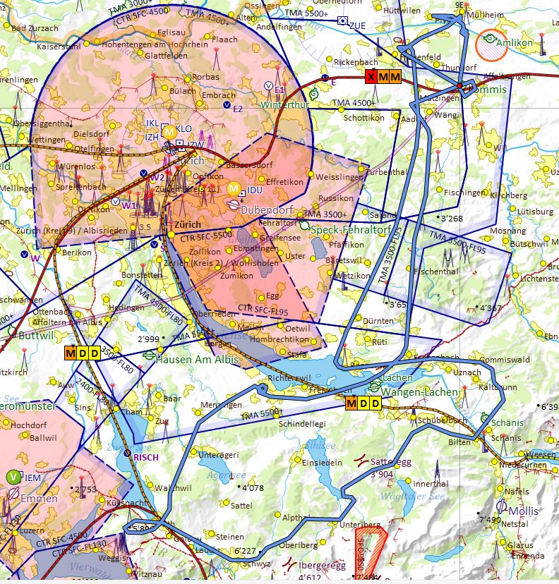
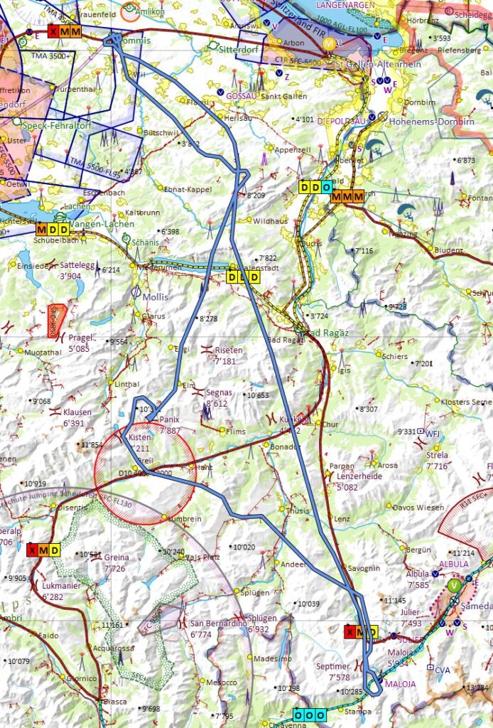
The route I flew can be seen below. In SkyDemon, past flights can be selected from the Logs menu for display and analysis. SkyDemon however doesn’t store weather and airspace information with the flights, so any meteorological and airspace information shown with a past flight is the one valid at the time when the flight is displayed again. The GAMET information near Lommis was for example OOO when I flew, but is shown as XMM below.
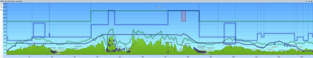
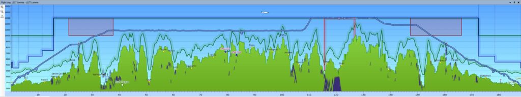
Below the altitude plot from SkyDemon, with the x-axis is in miles, rather than minutes. I flew nearly 190 miles (350 km) in 2:10, that’s an average speed of 87 knots (165 km/h).
After the flight I realised that I had flown for quite long at 13’000 ft, so I decided to a have a closer look at the applicable regulations. Do do that I first had to analyse the flight in relation to flying time, rather than flown distance. As SkyDemon doesn’t have that option I exported the flight log into a KLM file, which I then imported into Excel to generate the plot below. It shows the altitude in both metres and feet in reference to UTC, which is local time minus one hour.
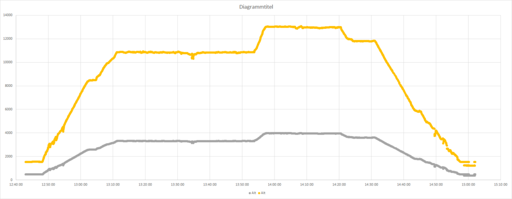
The plot shows that I reached 10’000 ft at 13:09 (UTC) in climb to 11’000 ft, which I reached at 13:11. I then stayed at that altitude until 13:56, when I climbed to 13’000 ft, remaining there until 14:21. I then descended again to 12’000 ft, where I stayed until 14:31 before starting the descent towards Lommis. Finally, I passed 10’000 ft again at 14:35. Overall I stayed at or above 10’000 ft for 1 hour and 26 minutes, at or above 11’000 ft for 39 minutes, at or above 12’000 ft for 26 minutes, at or above 12’500 ft for 25 minutes and at 13’000 ft for 23 minutes.
I analysed these times in such detail as I wanted to check how my flight compares with legal requiremens on oxygen usage. I normally don’t fly above FL120 for any longer period, but chose to do so due to the strong winds and the jet traffic towards Samedan airport. Being not 100% sure about the regulations I did sone research on the internet, where i first found the regulations published by the FAA. They say in 14 CFR § 91.211 – Supplemental oxygen:
(a) General. No person may operate a civil aircraft of U.S. registry –
(1) At cabin pressure altitudes above 12,500 feet (MSL) up to and including 14,000 feet (MSL) unless the required minimum flight crew is provided with and uses supplemental oxygen for that part of the flight at those altitudes that is of more than 30 minutes duration;
(2) At cabin pressure altitudes above 14,000 feet (MSL) unless the required minimum flight crew is provided with and uses supplemental oxygen during the entire flight time at those altitudes; and
(3) At cabin pressure altitudes above 15,000 feet (MSL) unless each occupant of the aircraft is provided with supplemental oxygen.
So the FAA says that you are not allowed to fly as crew above 14’000 ft without using oxygen, and not between 12’500 ft and 14’000 ft for more than 30 minutes, unless you are using oxygen. For passengers the only requirement ist that they use oxygen above 15’000 ft. So from an FAA point of view my flight was legal, but would not have been so if I had stayed five minutes longer at 13’000 ft. Good to know.
Trying to find corresponding rules from EASA was more challenging. I finally only found them through a link on the website of the Swiss Federal Office Civil Aviation FOCA, which points to the Commission Regulation (EU) 2016/1199 for rules on oxygen usage. This regulation contains changes to previous regulations, many of which are relaxations. Regarding the usage of oxygen on non-commercial flights in non-complex aircraft, the regulation states the following:
‘NCO.OP.190 Use of supplemental oxygen
(a) The pilot-in-command shall ensure that all flight crew members engaged in performing duties essential to the safe operation of an aircraft in flight use supplemental oxygen continuously whenever he/she determines that at the altitude of the intended flight the lack of oxygen might result in impairment of the faculties of crew members, and shall ensure that supplemental oxygen is available to passengers when lack of oxygen might harmfully affect passengers.
(b) In any other case when the pilot-in-command cannot determine how the lack of oxygen might affect all occupants on board, he/she shall ensure that:
(1) all crew members engaged in performing duties essential to the safe operation of an aircraft in flight use supplemental oxygen for any period in excess of 30 minutes when the pressure altitude in the the passenger compartment will be between 10 000 ft and 13 000 ft; and
(2) all occupants use supplemental oxygen for any period that the pressure altitude in the the passenger compartment will be above 13 000 ft.’;
Here the situation is quite different, as (a) essentially leaves it up to me as pilot-in-command to determine above which altitude and duration the crew requires oxygen. If the pilot-in-command is unable to dermine that then (b) applies, which contains rules stricter than those of the FAA. My interpretation of that rule for my flight of today is as follows:
(a) The pilot-in-command (myself) shall ensure that all flight crew members engaged in performing duties essential to the safe operation of an aircraft in flight (which is only myself, as I’m the only crew onboard and flying the aircraft) use supplemental oxygen continuously whenever he/she determines (I do that from personnal experience) that at the altitude of the intended flight (in this case 13’000 ft) the lack of oxygen might result in impairment of the faculties of crew members (which I negate for myself for flying at 13’000 ft, as I have done many flights at FL120 of two hours or more and flights up to 13’000 for shorter periods, and never had any issue doing that), and shall ensure that supplemental oxygen is available to passengers when lack of oxygen might harmfully affect passengers (which on this flight was no issue, as there was no passenger).
As a conclusion I consider the flight legal against the applicable EASA regulation, in addition it was also legal in the frame of FAA regulations.